Melrakkaslétta
Plan Melrakkaslétta with North Iceland route ideas, nearby towns and nature stops, Akureyri and Myvatn tours, itinerary links and practical FAQ.
Use this guide to connect Melrakkaslétta with practical nearby stops, relevant tours, itinerary ideas and route planning links.
Quick guide to Melrakkasletta
| Region | North-East Iceland, between Kopasker and Raufarhofn |
| Best for | Birdwatching, remote coastline, driftwood beaches, quiet roads and summer route planning |
| Nearby places | Raufarhofn, Kopasker, Langanes, Asbyrgi and Lake Myvatn route ideas |
| Typical visit time | 1 to 3 hours, longer for birdwatching and coastal stops |
| Best season | Summer, especially for birdlife and easier road conditions |
| Coordinates | 66°26'24.0"N 16°16'18.0"W |
What is Melrakkasletta?
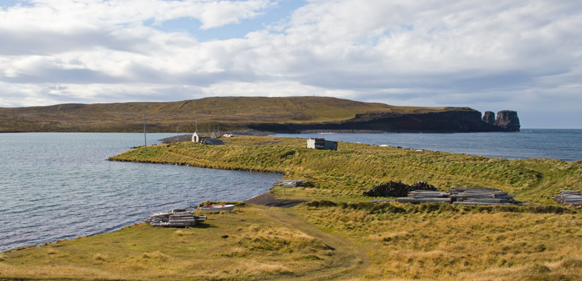
Melrakkasletta is a flat peninsula in North-East Iceland with low open landscapes, ponds, lakes, coastline and driftwood beaches. It is far quieter than the main Ring Road sights and suits travellers who want a more local, remote-feeling route.
The peninsula is known for birdlife, coastal scenery and long summer evenings. It is also close to some of Iceland's northernmost points and small villages such as Kopasker and Raufarhofn.

Melrakkasletta is a quiet coastal and birdlife area where summer timing and slow travel matter.
How to visit Melrakkasletta
Melrakkasletta is best visited by car in summer. The route can include gravel sections, open weather and limited services, so keep fuel, food and timing realistic.
It works well as part of a North-East Iceland day with Kopasker, Raufarhofn or Langanes, rather than as a rushed detour from the main tourist trail.
Tours near Melrakkaslétta
Melrakkaslétta works best when connected with stronger North Iceland booking paths around Akureyri, Husavik, Myvatn, Godafoss and the Diamond Circle.
Places near Melrakkaslétta
Use Melrakkaslétta as part of a North Iceland route with practical towns, waterfalls, lake areas and remote coastline.
Towns and villages near Melrakkaslétta
These towns are the most useful bases for services, tours and route planning.
Suggested North Iceland itinerary ideas
Melrakkaslétta as a short route stop
Keep Melrakkaslétta simple if the day already includes remote roads or a long drive.
Akureyri and Myvatn tour path
Use Akureyri as a base, then connect Godafoss, Lake Myvatn and a guided option such as Lake Myvatn Classic from Akureyri.
North-east coastal extension
Travellers going farther east can pair Melrakkaslétta with Asbyrgi, Dettifoss, Melrakkasletta or Langanes depending on road conditions.
FAQ about Melrakkaslétta
Is Melrakkaslétta worth visiting?
Yes, when it fits the route. Melrakkaslétta works best as a practical stop or planning anchor rather than an isolated detour.
Where is Melrakkaslétta?
Melrakkaslétta is in Iceland; use the quick guide and map above for the exact regional context before planning the drive.
How long do you need at Melrakkaslétta?
Most travellers need a short stop, while slower visitors can build it into a half-day route with nearby places such as Akureyri, Godafoss, Lake Myvatn, Husavik and Asbyrgi.
Can you visit Melrakkaslétta year round?
Often yes, but weather, daylight and road conditions matter. Check conditions before travelling, especially outside summer.
What places are near Melrakkaslétta?
Useful nearby ideas include Akureyri, Godafoss, Lake Myvatn, Husavik and Asbyrgi.
What tours work well with Melrakkaslétta?
The most relevant options are Lake Myvatn tours, Diamond Circle tours and Husavik whale watching, depending on whether you want sightseeing, activity tours or a guided route.