Description
This tour is currently unavailable and cannot be booked through Fun Iceland.
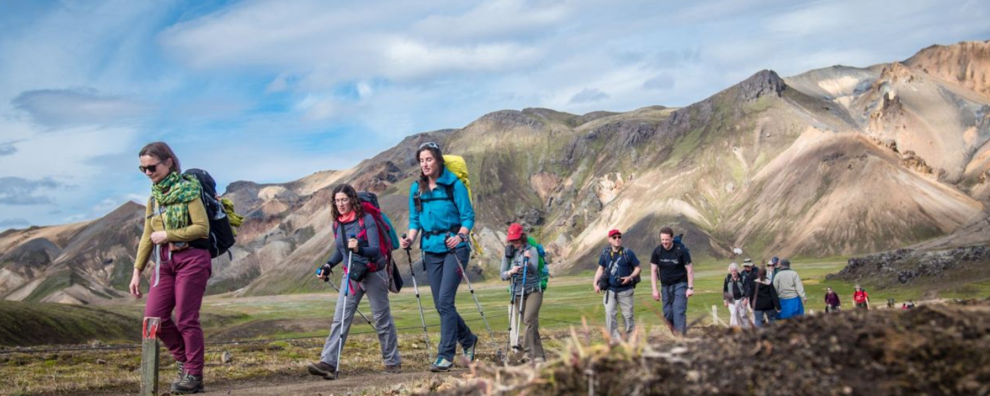
The Laugavegur Trail crosses Iceland's southern highlands from the colourful rhyolite mountains and geothermal landscapes of Landmannalaugar to the green birch valleys of Þórsmörk. Along the way, the route passes steaming springs, black-sand plains, deep canyons and glacier-fed rivers.
This page preserves a five-day version of the route as planning inspiration. It is not a current package or booking offer. Trail access, hut services, transport and river conditions can change, so hikers should always confirm current arrangements with the relevant operators and official safety sources before travelling.
Five-day route overview
Day 1: Landmannalaugar to Hrafntinnusker
The route begins in Landmannalaugar and climbs through a landscape of geothermal vents, small gorges and yellow-red rhyolite ridges before reaching the mountain hut at Hrafntinnusker.
Approximate distance: 12 km (7.5 miles) · Walking time: 4–5 hours · Ascent: 470 m (1,540 ft)
Day 2: Hrafntinnusker to Álftavatn
The trail descends through the gullies of Jökultungur, an area rich in steaming springs and mud pools. Wide views open towards Álftavatn and the Mýrdalsjökull and Eyjafjallajökull glaciers before the route reaches the lakeside hut.
Approximate distance: 12 km (7.5 miles) · Walking time: 4–5 hours · Descent: 490 m (1,610 ft)
Day 3: Álftavatn to Emstrur
From Álftavatn, the route passes the green slopes of Stórasúla and continues across the dark sands of Mælifellssandur. Near Emstrur, a side trip reveals the dramatic Markarfljót canyon before the day ends at the Botnar huts.
Approximate distance: 16 km (10 miles) · Walking time: 6–7 hours
Day 4: Emstrur to Þórsmörk
The trail winds through the valleys and gullies of Emstrur with Mýrdalsjökull rising nearby. The landscape gradually becomes greener as the route descends into Þórsmörk, known for its sheltered birch woodland and colourful summer vegetation.
Approximate distance: 17 km (10.5 miles) · Walking time: 6–7 hours · Descent: 300 m (985 ft)
Day 5: Exploring Þórsmörk
A fifth day allows time for a shorter walk in Þórsmörk. Possible routes include Sönghellir cave or the climb to Valahnúkur, where clear weather can reveal broad views across the surrounding valleys and glaciers.
Planning the trail
Laugavegur is a remote highland trek rather than a casual footpath. Hikers should be prepared for rapidly changing weather, limited services, shared mountain-hut accommodation and unbridged river crossings. Daily distances and timings are approximate and may vary with route choices and conditions.
What is included
Nothing is included or booked through this page. It is retained for historical and route-planning information only.
What do I need to bring
Conditions on the Laugavegur Trail can change quickly. Pack for cold, wind, rain and bright sun even during summer, and keep essential clothing and electronics in waterproof bags.
Clothing and footwear
- Waterproof hiking boots with good ankle support
- Moisture-wicking base layers made from wool or synthetic fabric
- A warm fleece or wool mid-layer
- Quick-drying hiking trousers
- A waterproof and windproof jacket and overtrousers
- Warm hat, gloves and two or three pairs of hiking socks
Essential equipment
- A comfortable 25–40 litre daypack
- A warm sleeping bag suitable for mountain huts
- Lightweight shoes with secure grip for river crossings
- Water bottle, sunglasses and sun protection
- Headlamp, towel, toiletries and personal medication
- A small first-aid and blister-care kit
- Dry bags for spare clothing and electronics
Trekking poles, gaiters, neoprene socks and earplugs can also be useful. Avoid cotton clothing for exposed mountain walking because it dries slowly and provides little warmth when wet.
Good to know
- Route: Landmannalaugar to Þórsmörk through Iceland's southern highlands
- Typical format: Five days of hiking with overnight stays in mountain huts
- Distance: Approximately 56 km (35 miles), depending on route choices
- Daily walking: Commonly 4–7 hours
- Terrain: Mountain paths, loose volcanic ground, steep sections and unbridged rivers
- Season: Highland access is generally limited to summer and always depends on road, trail and weather conditions
- Accommodation: Huts are shared and must be arranged independently; nothing is booked through this page
- Safety: Check current weather, road access, trail conditions and official travel alerts before setting out
Highlights
- The rhyolite mountains and geothermal landscapes of Landmannalaugar
- Black-sand highland plains framed by glaciers and volcanic peaks
- The deep Markarfljót canyon near Emstrur
- Mountain-hut stages across a remote and varied landscape
- The birch valleys and panoramic hiking routes of Þórsmörk