Reykjavík City Hall and Tjörnin
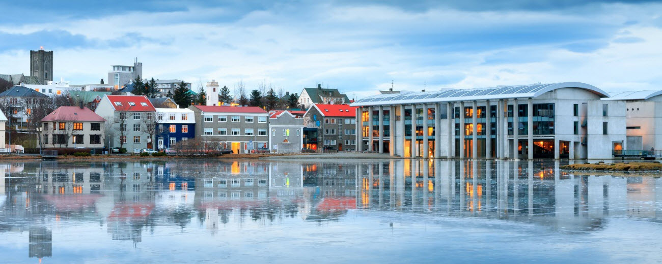
Reykjavík City Hall stands partly over Tjörnin pond in the historic centre, combining civic offices with a public ground floor, changing exhibitions and a large relief map of Iceland. Its waterside architecture, birdlife and nearby old-city streets make it an easy and rewarding stop.
Quick guide to Reykjavík City Hall
| What it is | Reykjavík’s municipal headquarters and a public cultural space beside Tjörnin |
|---|---|
| Opened | 1992 |
| Architects | Studio Granda |
| Admission | Free to enter the public ground-floor areas during opening hours |
| Highlights | Relief map of Iceland, exhibitions, modern architecture and pond views |
| Time to allow | 20–45 minutes, longer with a full walk around Tjörnin |
| Good to know | Municipal services continue during visits; events can affect access |
| Coordinates | 64.1460667, -21.9425144 |
Why visit Reykjavík City Hall?
Reykjavík City Hall is both a working civic building and one of the most accessible pieces of modern architecture in the old centre. The building appears to sit in Tjörnin, with water passing beneath bridges and close to the dark concrete walls. Inside, the public ground floor offers shelter, changing displays and a useful overview of Iceland through its large three-dimensional relief map.
The visit also gives context to the surrounding city. On one side lie the administrative offices and old streets around Austurvöllur; on the other, Tjörnin opens towards gardens, colourful houses and the bird-rich southern shore. It works especially well as the centre point of a short self-guided walk.
Architecture shaped by water
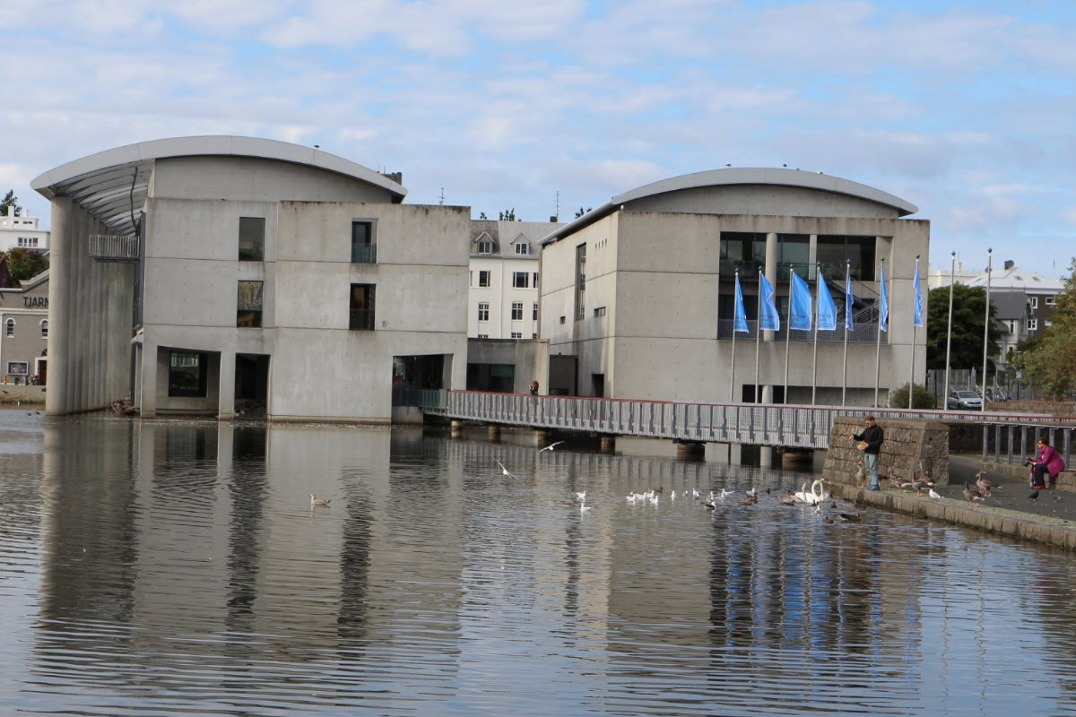
Studio Granda designed the building as a deliberate contrast to the older centre. Concrete, glass and weathered surfaces are softened by the pond, while walkways draw pedestrians across and around the structure. Water is not decoration added after the fact: it flows beneath parts of the building, reflects the elevations and helps connect the public interior with Tjörnin.
Approach from Tjarnargata to see the relationship between street and pond, then cross the pedestrian bridge and walk around the water-facing edges. Rain, snow and low winter light can make the dark materials especially atmospheric; bright summer days bring out reflections and birdlife.
The relief map and public ground floor
Tjarnarsalur, the ground-floor public hall, hosts exhibitions, meetings and civic events. Its best-known feature for travellers is the large raised relief map of Iceland. Mountain ranges, glaciers, valleys and volcanic plateaux become easier to understand at this scale, making the map useful near the beginning of a road trip or after visiting several regions.
Access to individual displays can change because City Hall is a working municipal building. Keep voices low around offices and meetings, and follow any temporary signage. If the map or a particular exhibition is essential to your plans, confirm current public hours before travelling.
Tjörnin pond and birdlife
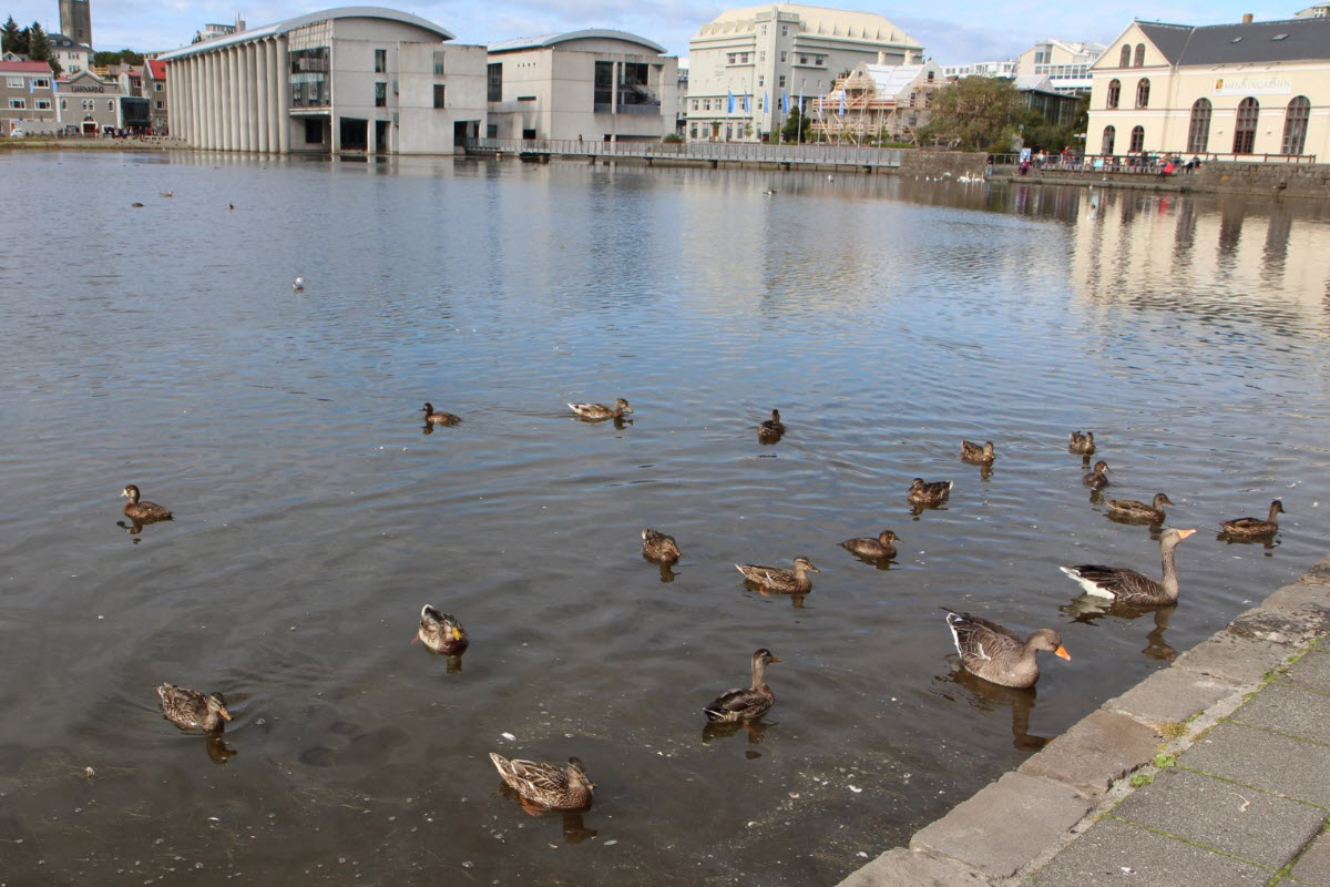
Tjörnin is often translated as “the Pond”, but it is one of central Reykjavík’s defining landscapes. Swans, geese and many duck species use the water and surrounding lawns. The best experience is quiet observation from paths and benches. Do not feed birds bread: it has poor nutritional value and can worsen water quality. Keep a respectful distance during nesting and moulting periods.
A complete circuit links City Hall with Hljómskálagarður park, residential streets and viewpoints back towards Hallgrímskirkja. In winter the pond may partly freeze, but conditions vary and visitors should never assume ice is safe without official local guidance.
Getting there and a useful old-city route
City Hall is at Tjarnargata 11, a few minutes on foot from Austurvöllur, Parliament House and Reykjavík Cathedral. Lækjartorg and other central bus stops are nearby. Walking is usually easier than driving because parking in the old centre is limited and charged.
A compact route begins at City Hall, crosses to Austurvöllur, continues to Harpa and returns beside the water or through the old streets. For a greener variation, walk south around Tjörnin before climbing towards Hallgrímskirkja.
Reykjavík city tours near City Hall
These live FunIceland tours begin in or pass through the central area and add local history, folklore, food and architecture to the visit.
See also in Reykjavík
Continue with three places that fit naturally into an old-Reykjavík walk.
Frequently asked questions about Reykjavík City Hall
Yes. The public ground-floor areas are normally open free of charge during building hours, although municipal events can affect access.
The large three-dimensional map is in the public ground-floor area of City Hall. Its availability can change during events.
The building opened in 1992 after a long public debate about placing a modern civic building beside Tjörnin.
The Icelandic architecture practice Studio Granda designed the building.
Allow 20–45 minutes inside and around the building. A complete walk around Tjörnin takes longer.
No. Bread is unsuitable for waterbirds and feeding can damage water quality. Observe quietly from paths and benches.
Never assume that frozen water is safe. Conditions change quickly; remain on maintained paths unless local authorities explicitly say otherwise.
The public entrance and main ground-floor areas are designed for general access. Temporary events may alter routes.
Austurvöllur, Parliament House and Reykjavík Cathedral are close, while Harpa and Hallgrímskirkja fit into a longer central walk.
Paid city-centre parking is available nearby, but walking or using public transport is usually simpler.