Hjörleifshöfði Cape
Hjörleifshöfði is a cape located on the west part of Mýrdalssandur black sand area about 15 km east of Vík. By the settlement time of Iceland the coast line there was further in land so a part of the cape was standing out in the ocean by the end of the fjord that was there at the time.
The name of the cape is from the viking who settled there his name was Hjörleifur Hróðmarsson and he was the brother of Ingólfur Arnarsson who was the first settler of Iceland in the year 874, and lived in Ingólfshöfði cape before he settled Reykjavík. Hjörleifur was killed by his Irish slaves, after the killing his slaves ran away and went to the Vestmannaeyjar islands. Ingólfur hunted them down and killed them all there. Hjörleifur was buried on the top of the cape and his tomb is still there.
People have lived in or by the cape since the settlement time. The first farm was build on the low land on the west side of the cape but after the volcanic eruption in Katla volcano in 1721, when there was a big glacier flood that came down to Mýrdalssandur area and destroyed the farmhouses there they moved the farm up on the cape to be safe from Katla and the glacier floods.
One of the last farmers to live in Hjörleifshöfði was Markús Loftsson he was a rich farmer and known for publishing the Eldritið (The book of fire) a book about the Skaftáreldar volcanic eruption in 1783. Markús was married three times his last wife was 24 years old when he married here, he was then 60 years old and they did have three children together. Since 1936 no one have been living in the cape.
The cape is around 251 hectare in size and about 221 meter high, but the land that belongs to the cape is about 115 square kilometers. Even though the farmland was not great there was a lot of seabirds and driftwood there so people who lived there did not do so bad. The cape is formed after a volcanic eruption under a glacier like other mountains in the area. Main rock type is tuffstone mixed in with lava rock. The volcano Katla has played a big role in the area around the cape by leaving a lot of sand around the cape so now the coast line there has been moving south after glacier floods from Katla. For example after the volcanic eruption in Katla in 1918 the coast line south from the cape moved forward about 2 kilometers.
The main bird type nesting in the cape is Fulmar but on the black sand area around you can find Seagulls, Golden Plover, Ringed Plover and Whimbrel for example.
Directions
There is a great view from the cape over the black sand area of Mýrdalssandur, north to Mýrdalsjökull glacier and south to the coast line and Vík. It is easy to hike to the cape the hike to the top where the viking tomb is takes around 40 minutes.
Hjörleifshöfði is located about 2 hours and 40 minutes (194 km) drive from Reykjavík. Take Ring Road nr. 1 towards the town Vík. From Vík drive for about 15 minutes and then turn right where the sign says Hjörleyfshöfði. Drive few meters to the parking area by the cape.
Read more about Driving in Iceland.
Hjörleifshöfði: 63°25'01.5"N 18°46'00.5"W
Accessible all year round
Length of hiking route: 40 minutes one way
Difficulty: Easy/Medium

Ride an ATV across black sand beaches to the famous DC-3 plane wreck. A powerful South Coast adventure with wild ocean views.
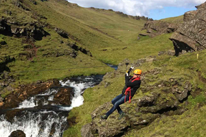
Fun South Iceland zipline adventure with canyon views, fresh air and a playful rush.