Dyrfjöll Mountain and Stórurð Hiking

Dyrfjöll is a beautiful mountain in the East of Iceland on the way to Borgarfjörður Eystri fjord with highest summit 1136 meters high. The name Dyrfjöll means the door mountains, the shape is very different from many other mountains in Iceland with steep vertical walls and a big gap (856m high) in the middle.
Dyrfjöll is an old volcano formed during or before the last ice age. Erosion by the movement of the glacier ice slowly cuts down the weakest part of the mountain. The rocks then fall down on the glacier and when the glacier melts the rocks are left on solid ground.
Some people living in Borgarfjörður Eystri believe that Dyrfjöll are the home of Grýla and Jólasveinarnir (The Icelandic Christmas lads and their mom Grýla)
Dyrfjöll will catch your eyes from a distance and the closer you get the better and more amazing it gets.
It is around 50 minute drive from Egilsstaðir town to the place you start the hike to Dyrfjöll on a parking by road number 94 (Borgarfjarðarvegur).
The Hike
There are few places where you can start the hiking from. Most people start from the parking on the top of the mountain ridge in Vatnsskarð by Vatnaskarðsvatn lake. There is a big parking there and a small house with information about the hiking and the nature in the area. And it is also a great place to use bathroom if you are in need before going on the hike.
The hiking starts with ascending on to the top of the Vatnsskarð mountain, the hill is not so steep but it is good to have a slow start to warm up for the rest of the hike. The distance from the parking to Stórurð and Dyrfjöll is about 7,5 km or about 2.5 to 3 hours of hiking.
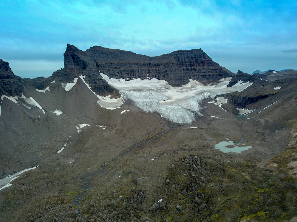
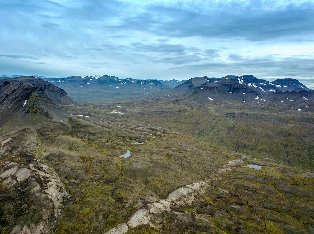
On the way you will get some great views to North to Héraðsflói bay and Lagarfljót river and south to Dyrfjalladalur valley. As you approach Dyrfjöll you will get a better view of the mountain and the gab with steep hills, at the end of Vatnsskarðs fjall mountain you will go down to Stórurð, an area with huge rocks spread over the floor of the valley Urðardalur.
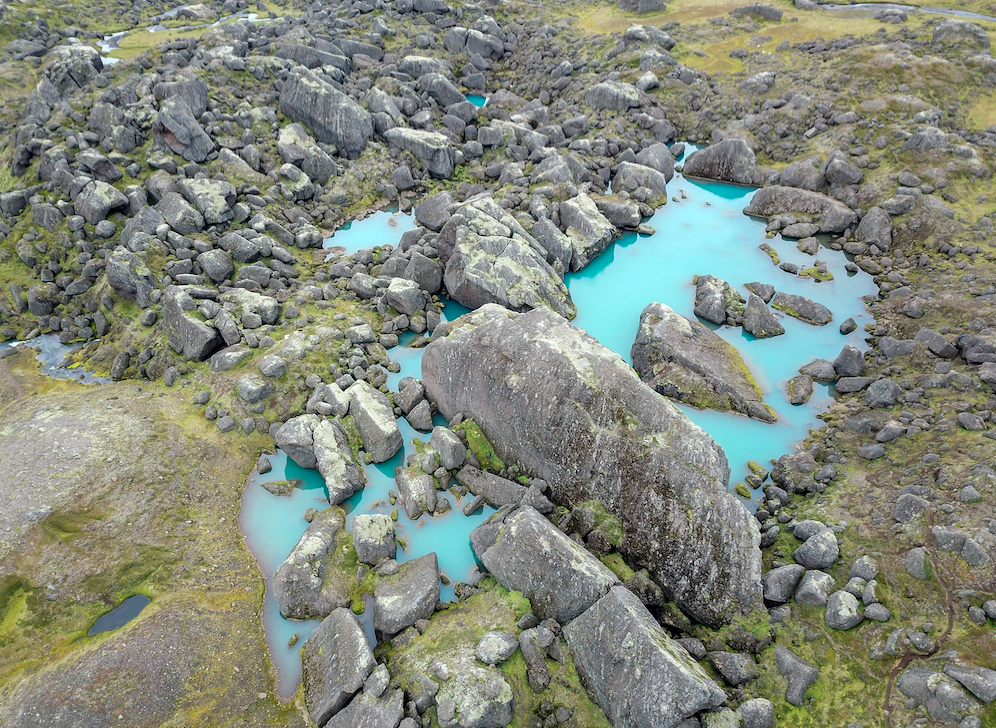
Standing down in the valley is amazing with all this huge rocks spread all over the valley and a small stream flowing around them and in the background you have the Dyrfjöll and a small valley glacier.
It is nice to walk in the valley around these big rocks. Just be careful to stay on the path. On the way back you can choose between few different paths, I would recommend to go the same way back it is the shortest although it is a little steep in the beginning.
You also have an option to walk down the valley it is a little bit longer hike and the view is not as interesting as going across Vatnsskarðsfjall mountain.
Good to know
Make sure you are well prepared for the hike, the wether can be changing form time to time and you need to bring some extra layers of clothes with you, and make sure you have something wind and water proof.
Coordinates and information:
Start point in Vatnsskarð: 65° 33.692' -13° 59.660'
Stórurð: 65° 30.996' -13° 59.482'
Distance: 7,5 km one way
Estimated hiking time: 2.5 to 3 hours one way.
Book Your Adventure
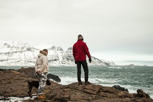
Super Jeep adventure beyond the normal road, with big landscapes, rough tracks and local guiding.
Super Jeep adventure beyond the normal road, with big landscapes, rough tracks and local guiding.
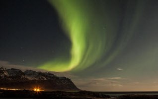
Using our local experience we will find the best place to see the Northern Lights in East Iceland.
Super Jeep adventure beyond the normal road, with big landscapes, rough tracks and local guiding.
Super Jeep adventure beyond the normal road, with big landscapes, rough tracks and local guiding.