Skeifárfoss waterfall – the Hidden Pearl of the Tjörnes Peninsula
Hidden away on the Tjörnes peninsula in North-Iceland a beautiful waterfall, Skeifárfoss - the Waterfall of Skeifá river, cascades down a sedimentary cliff like a beautiful bridal veil.
The Tjörnes peninsula is a part of the popular Diamond Circle, as it connects 2 of the 5 key destinations on the Diamond Circle, Ásbyrgi and Húsavík town, which is also known as the Whale watching capital of Iceland.
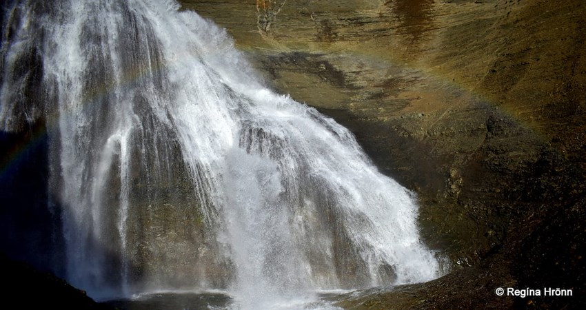
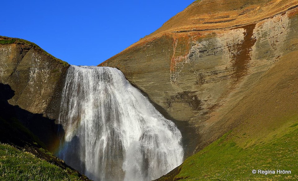
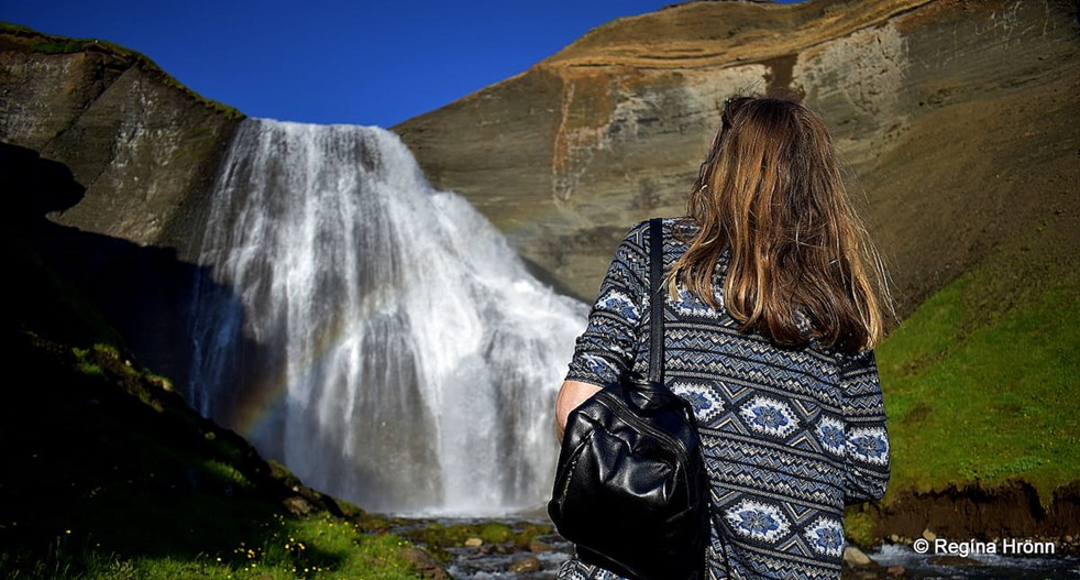
A rainbow by Skeifárfoss waterfall
An hour’s beautiful, albeit a bit rocky, hike took us to the hidden waterfall‘s location. The waterfall can only be seen from the sea, and not from the road, and that is why it is not visited by many.
I am a big fan of waterfalls and go out of my way to see pretty waterfalls, especially waterfalls which spread like bridal veils (slæðufoss in Icelandic), they are a favourite of mine.
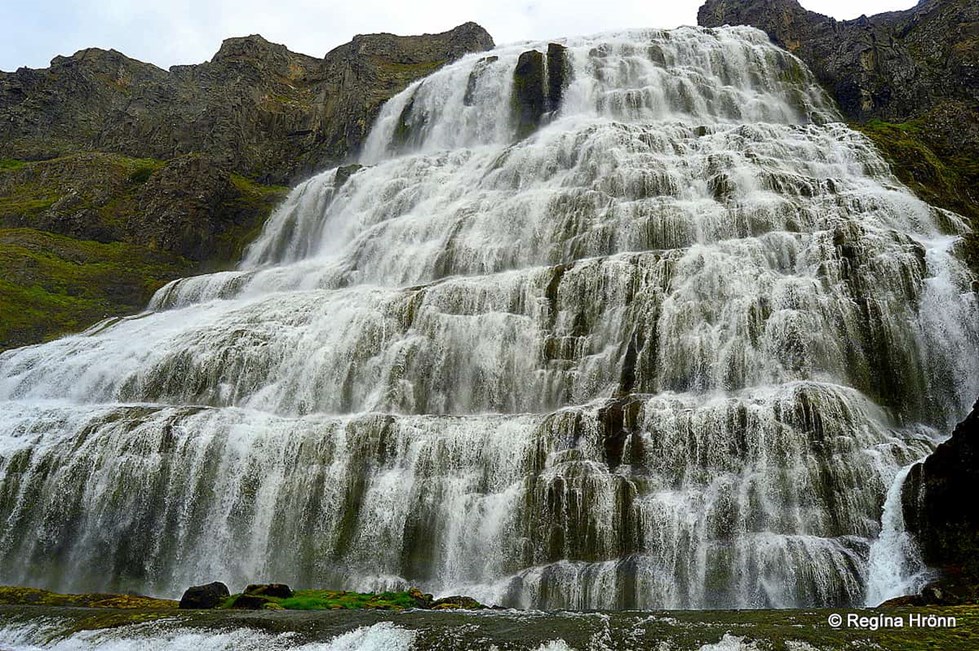
The bridal veil waterfall Dynjandi, the Jewel of the Westfjords
I have shown you a couple of such waterfalls in other travel-blogs, f.ex. Dynjandi waterfall in the Westfjords of Iceland and Hvítserkur waterfall in West-Iceland.
I had read about and seen photos of Skeifárfoss waterfall some years ago in an excellent Icelandic travel-book, called 155 Ísland Áfangastaðir, by Páll Ásgeir Ásgeirsson and fell in love with its bridal veil appearance and beautiful surroundings.
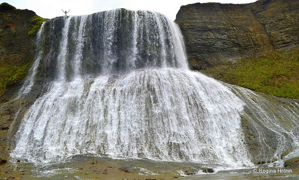
The bridal veil waterfall Hvítserkur in West-Iceland
But the weather conditions had to be favourable, sunny, and blue skies, and I wanted to visit it in the evening when the sun shone directly at it.
Not a small order as I live in Reykjavík, some 470 km away from the waterfall. But finally, in the summer of 2020, my husband and I went searching for it in beautiful weather at 19:00 in the evening 😊
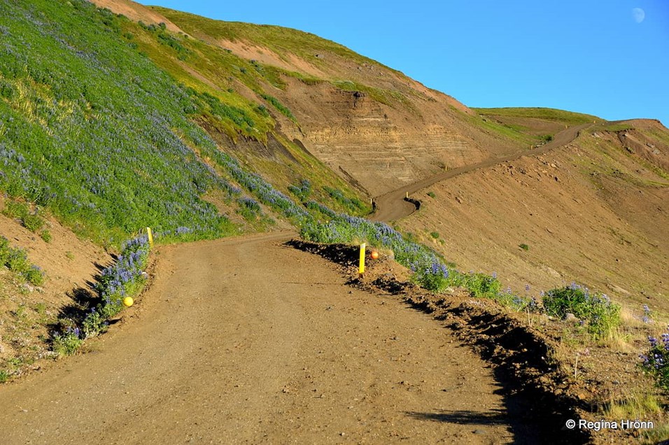
Tungulending. The gravel road leading down to the sea is quite steep
Skeifárfoss waterfall is located between the farms Hringver and, Ytri-Tunga and Tunguvellir farms on the Tjörnes peninsula, some 12 km away from Húsavík town.
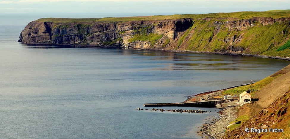
We left road 85 and drove down the steep gravel road leading to the guesthouse Tungulending by the sea at Tjörneshöfn and left our car there.
The guesthouse is in a house by a harbour which was used by local fishermen.
Driving down to Tungulending
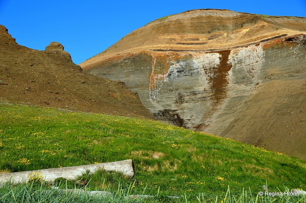
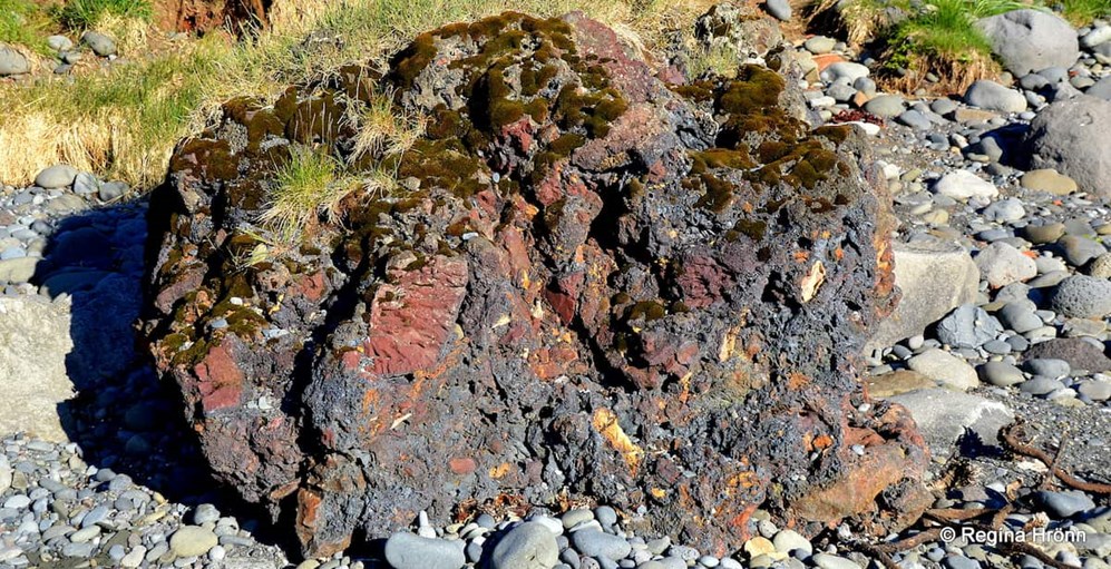
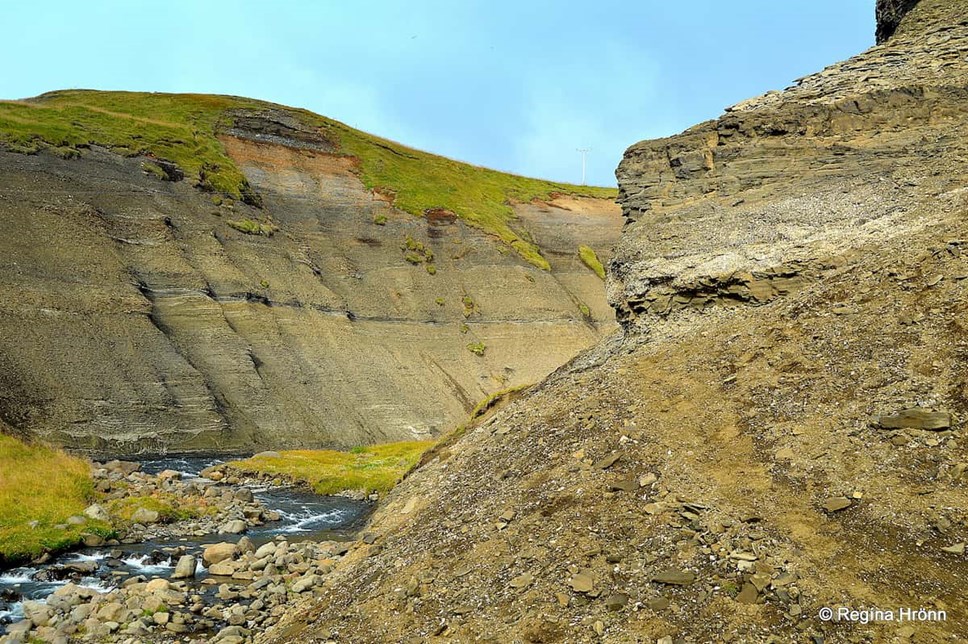
This area is very rich in fossils and the Tjörnes peninsula is best-known for its sedimentary strata, Tjörneslögin, which are quite extraordinary and unique.
The steep road cuts through this fragile geological phenomenon, which strangely enough is not yet preserved.
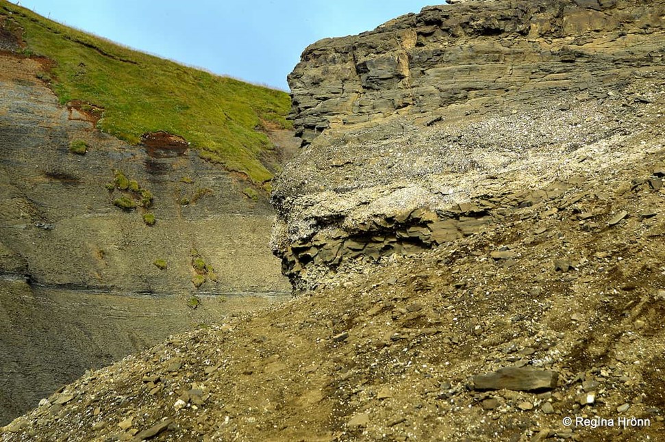
Tjörneslögin sequence
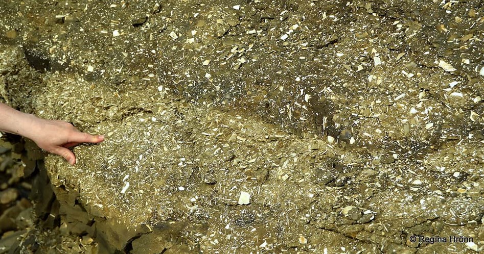
The oldest parts of Tjörneslögin are millions of years old, with thick layers of ancient, fossilized seashells and conches. Lignite can also be found here.
Nowhere else in Iceland can sedimentary strata of this nature be seen.
Layers upon layers of ancient seashell fossils are embedded in and crumbling from the sea cliff walls.
Tjörneslögin sequence
Visiting Tjörnes must be a feast for geologists as the cliffs are like a cross-section of millions of years of history.
On the hike by the sea, we saw many large beautiful ancient fossils which were about to be washed out to sea by the waves.
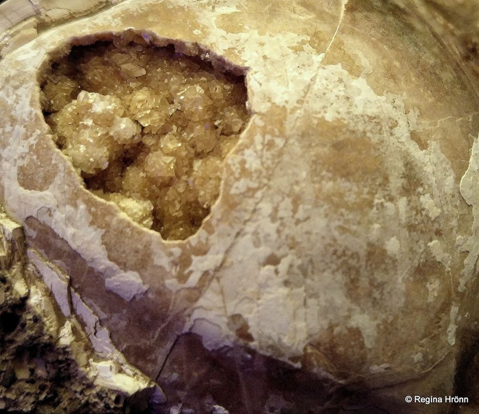
A large piece which I noticed on the shore about to be washed away to sea
I took up a large piece on the shore to examine it and inside the huge shell, crystals were glistening.
I felt bad that these beautiful fossils would be lost forever from sight in the sea. But this is of course where they came from in the beginning.
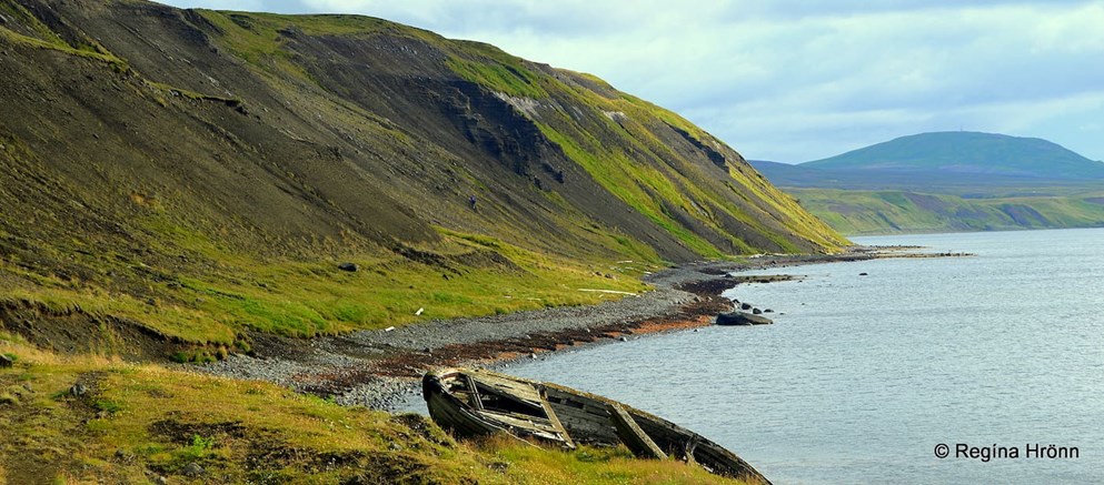
The route to the waterfall – an old boat wreck on the beach
Even though this area is not yet preserved, it is a natural site on the Nature Conservation Register (náttúruminjar no. 530) and according to the nature preservation law (no. 60) it is prohibited to remove the fossils.
So, let’s tread lightly as this is a very fragile area, and only take photos and leave nothing but footprints.
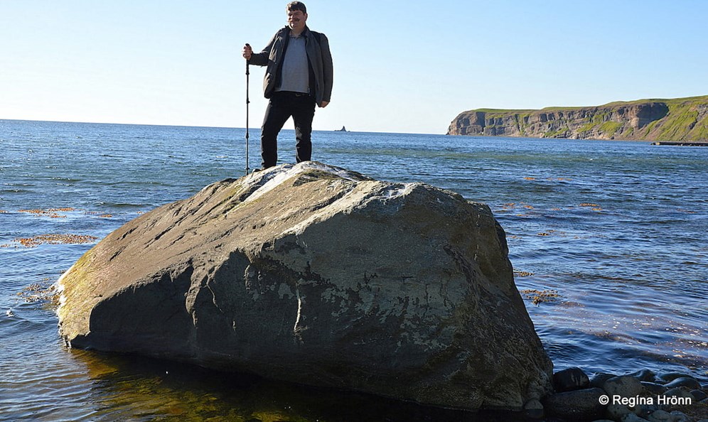
Grænlandssteinninn rock
At the beginning of the hike, we noticed this huge granite rock, Grænlandssteinninn rock, which drifted to Iceland on an iceberg all the way from Greenland.
The rock has got a name, Torfasteinn or the Rock of Torfi, and supposedly folklore is related to it, but no matter where I looked, I couldn’t find the source of that folklore.
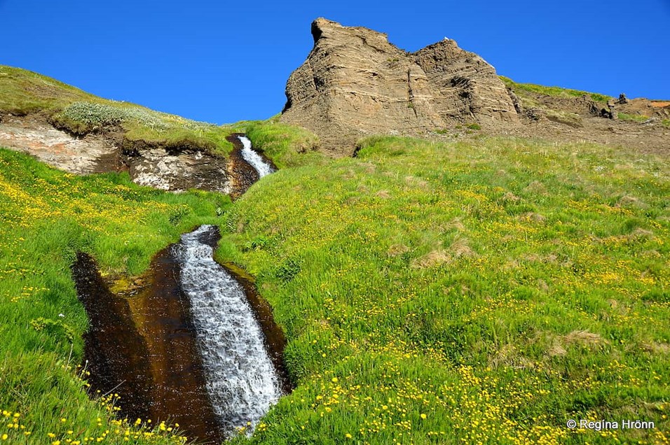
Beautiful scenery on the hike
The route to Skeifárfoss is so pretty in the summertime when the migrating birds own the beach and the rocks.
Fortunately, there were no Arctic terns here, just friendly birds, and thus no bird attacks, but the Arctic tern has attacked me way too often on my hikes. So this was a leisurely walk.
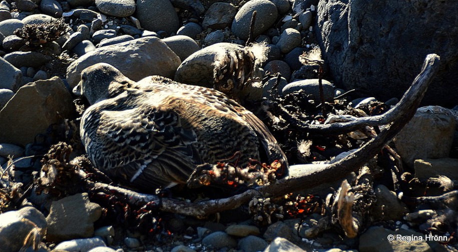
Eider duck blending in with the rocks and seaweed
Take care as not to step on any eider duck in camouflage - we almost steeped on one mother on her nest as we did not see her. She blended it with the surroundings and was almost invisible.
She didn't budge even though, but we were quite startled. This is obviously an off-the-beaten-path location.
But these birds are also known for not flying from their nests even if disturbed I have heard.
It must be around this bend…
I am not good with walking on beach rock, so I followed a path made by sheep in the grass whenever I could see one. Some balancing exercises were needed though ;)
Fortunately, I had brought a walking stick.
Finally, we reached Skeifárfoss waterfall after a little under an hour's hike and many "it must be behind the next bend" and “Are we there yet? “as we had no idea how long the hike was 😊
We finally reached Skeifárfoss waterfall, and I was in awe
But an hour's hike on a rocky beach was worth it for me to see this beautiful bridal veil waterfall with my own eyes.
The surroundings by Skeifárfoss are magical like I had walked into a painting. It was just perfect.
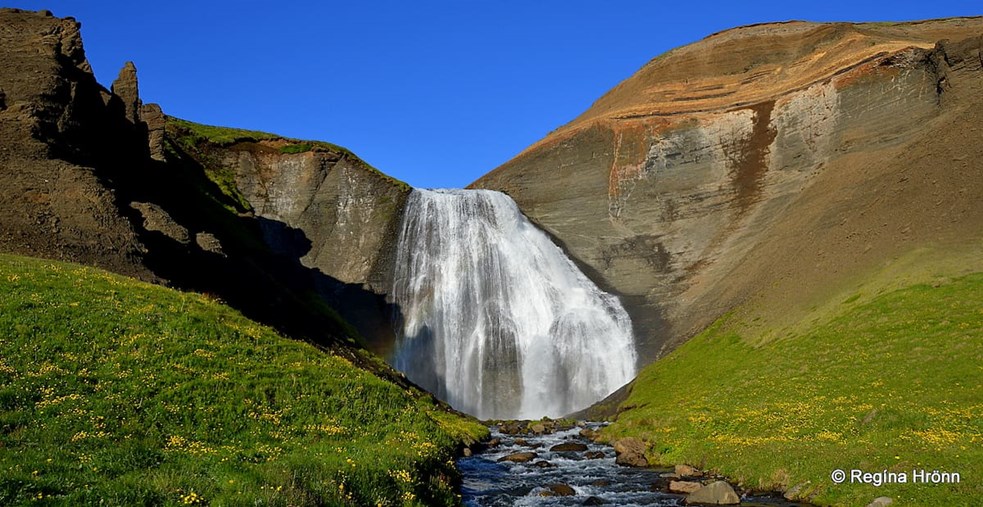
Skeifárfoss cascades down from the sedimentary cliffs
And now you can see why I wanted to be by the waterfall so late in the evening as the sun was shining directly at Skeifárfoss and there was almost no shadow on it.
The light brown colours of the sedimentary Tjörneslög layers beautifully complemented the waterfall – and the sun made the colours more bright and vivid.
And of course, the blue sky and the rainbow were a huge bonus.
You will see several pillars of rocks by the waterfall and in the cliffs, we call them trolls - I like to call them the protectors of the waterfall.
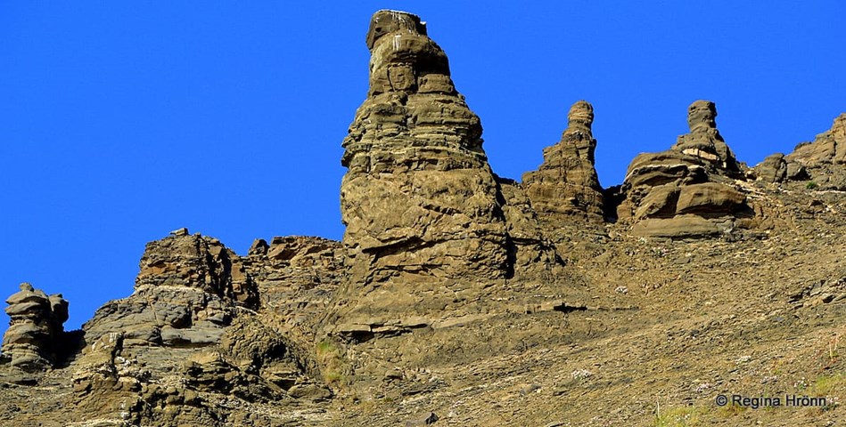
Pillars of rocks in the cliffs – if you look closely, you will see a face in the middle one
A short distance from Skeifárfoss waterfall Skeifá river runs its course in the sea.
While driving on the Tjörnes peninsula you will see 3 small islands, the 2 Mánáreyjar islands called Háey and Lágey – the High and Low Island.
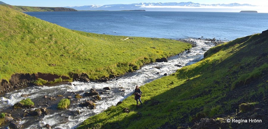
Skeifá river runs its course in Skjálfandaflói bay - Lundey island in the distance.
And by Skeifárfoss waterfall you have a good view of Lundey – the Puffin Island, which is the biggest one of the islands by Tjörnes.
After admiring Skeifárfoss for the longest time it was now time to leave and stumble back on the rocks on the beach for another hour 😉
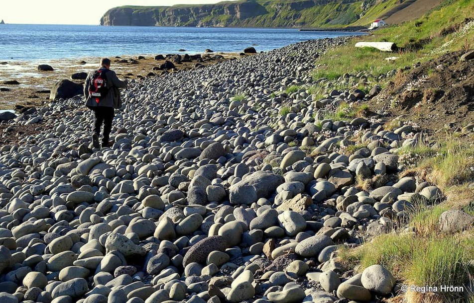
The rocky beach
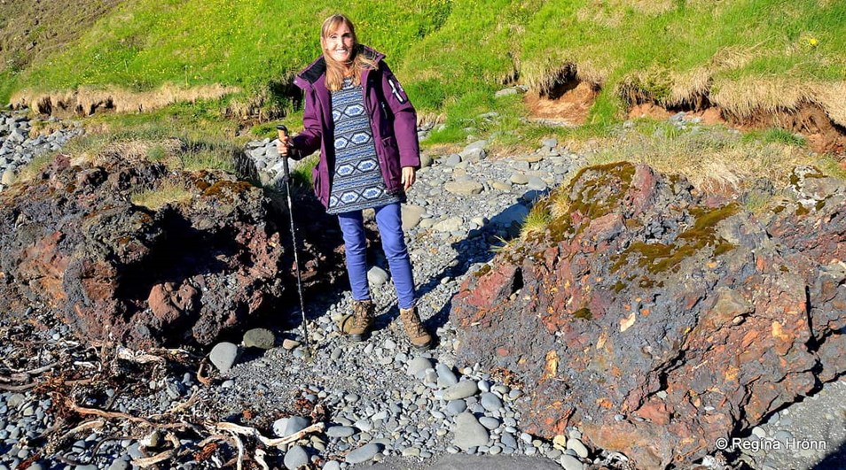
On the hike to and from the waterfall, we noticed these huge colourful rocks, which looked like red lava.
This is lignite from an old mine, but in around 1916-1918 (and even later) lignite was mined here from the surtarbrandslög layers (surtarbrandur is the Icelandic term for lignite).
There were 2 lignite mines, the mine on the property of Ytri-Tunga farm was run by the state and the mine on the property of Hringver farm was run by the fishing operator Þorsteinn Jónsson.
Lignite on the beach
During WW1 in 1914-1918, Iceland couldn’t import enough coals. And go figure that 1918 has been called Frostaveturinn mikli or the Winter of the Great Frost.
Drift-ice closed the harbours from January-March and polar bears came ashore.
My great-grandfather, Bjarni Benediktsson from Húsavík, whom I told you about in my Grenjaðarstaður travel-blog, wrote in his diary that the temperature went down to -33 degrees C in Akureyri and -36 degrees C at Grímsstaðir á Fjöllum!
Lignite on the beach
That was also the year of the Spanish flu and the notorious volcano Katla in South Iceland erupted, so it has gone down in history as an annus horribilis for Iceland.
So the locals tried mining lignite to use as coals. In 1914 Bjarni, who was a merchant at Húsavík, opened a small store in a shed on the shore by Hallbjarnarstaðir and sold lignite with the help of the farmer at Hallbjarnarstaðir farm.
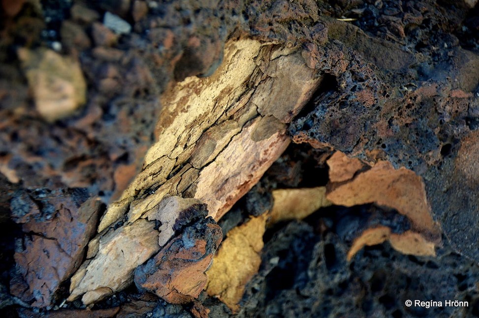
Lignite – brown coal up close
Lignite didn‘t work as well as coals, but I hope that it helped to a degree.
It wasn‘t the first difficult year for Icelanders back then for sure as 1881-1882 was another period of great frost with drift ice closing the harbour and measles killing a lot of the countrymen, including many of my relatives.
Again, in 1917 measles struck this area. And in my great-grandfather’s diary is written that the houses were cold, and everybody, ill and mobile, gathered in the biggest room in Bjarnahús house in Húsavík, which had been changed into a sickroom.
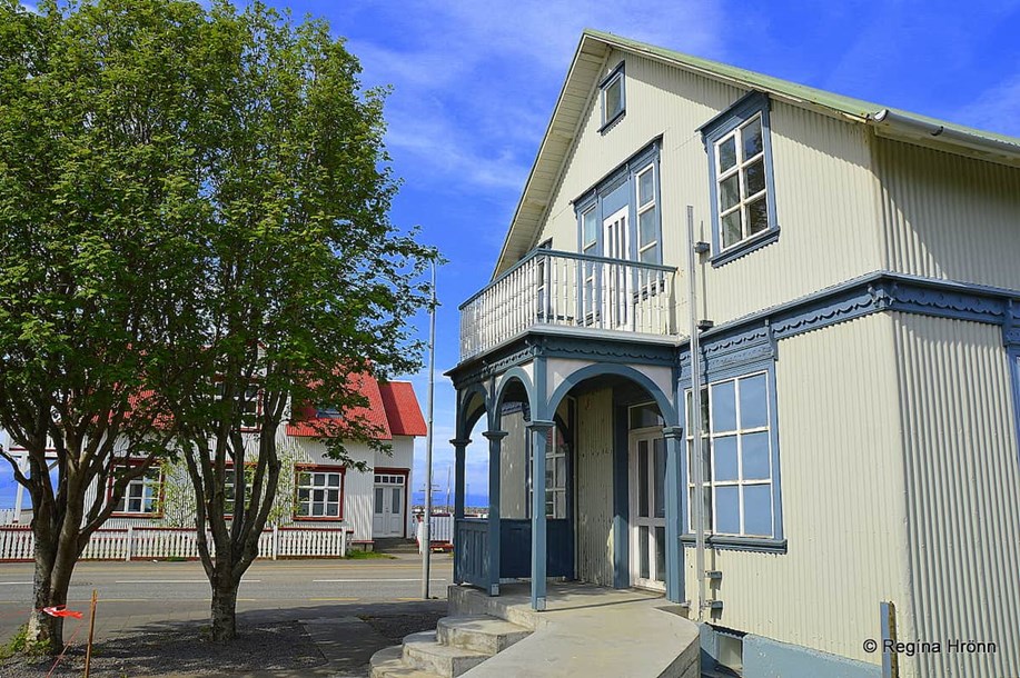
Bjarnahús in Húsavík, the house where my grandmother was born – it is next to the church
A big oven heated the room up with lignite from the Tjörnes mines. And again, a relative was lost to the dreadful measles.
The lignite mine has now collapsed. There were embers of a fire in a huge pile of debris from the lignite mine for some 2 years here on the beach, from 1918.
What is left of these piles of leftover lignite can be seen on the shore.
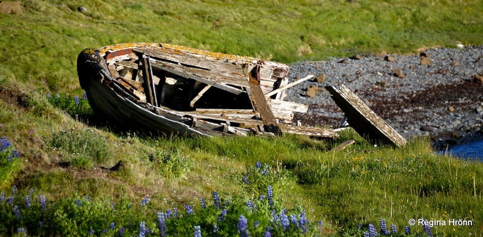
Remnants of an old fishing boat on the beach
Seeing that this area is delicate and cannot withstand too much traffic then I am in no way recommending this waterfall as a major stop, but only showing you some of the lesser-known pearls of Iceland.
I have the advantage of living in Iceland, so I have the time to visit many lesser-known areas, whereas our foreign visitors are most often on a tight schedule and want to see the most popular sights in Iceland.
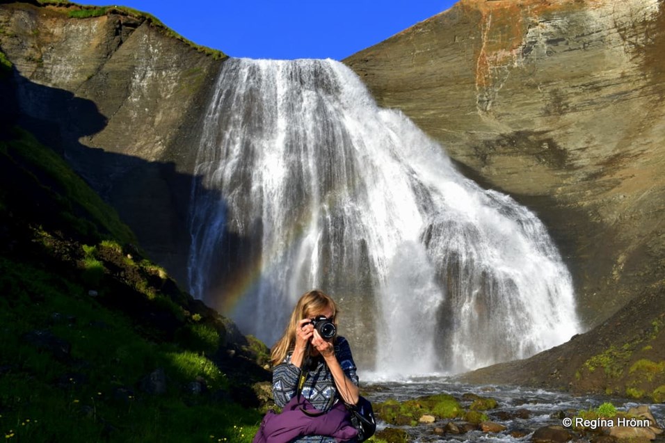
Photographing the surroundings by Skeifárfoss waterfall unaware of my husband photographing me 😉
In this area there are plenty of popular sights as here we are both on the Diamond Circle and the Arctic Coast Way.
If you want to visit this area, turn from road 85 onto a gravel road by the sign Tungulending some 12 km north of Húsavík town.
Tjörneslögin layers by Hallbjarnarstaðaá river
There is a gate on this road, let’s not forget to close it, and drive down the steep hill by the cliffs towards the sea until you reach Tungulending guesthouse.
You can also leave your car on top of the cliffs and walk down the steep road.
Tungulending is located at 66.1391624,-17.2650899,1455
Other sights of interest in this area are the Geosea Seabaths, Húsavík town and the Gatanöf arch-rock.
Have a lovely time in Iceland 😊
Book your tour

A South Coast ATV adventure with black sand, riverbeds, volcanic scenery and an active way to explore Iceland's wild coastline.
Easy Skaftafell glacier hike with blue ice, crevasses, mountain views and certified glacier guides.
Snorkel between two continents in the crystal-clear waters of Silfra in Þingvellir National Park.
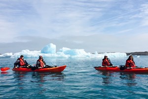
Self-drive kayaking at Jökulsárlón Glacier Lagoon near Vatnajökull, paddling among icebergs in a drysuit.

Chase the Northern Lights from the Reykjavik coastline, with dark ocean horizons, warm indoor space and a different view of the au...
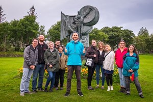
Easy culture experience with local stories, character and insight that adds more depth to your Iceland trip.

A Golden Circle and Secret Lagoon tour combining classic sights with a relaxed natural hot spring stop.
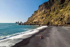
An easy Icelandic horse riding tour on the black sand coast near Vik, with ocean views and South Coast atmosphere.