Visiting Bolungarvík Village in the Westfjords of Iceland - the End of Road 61
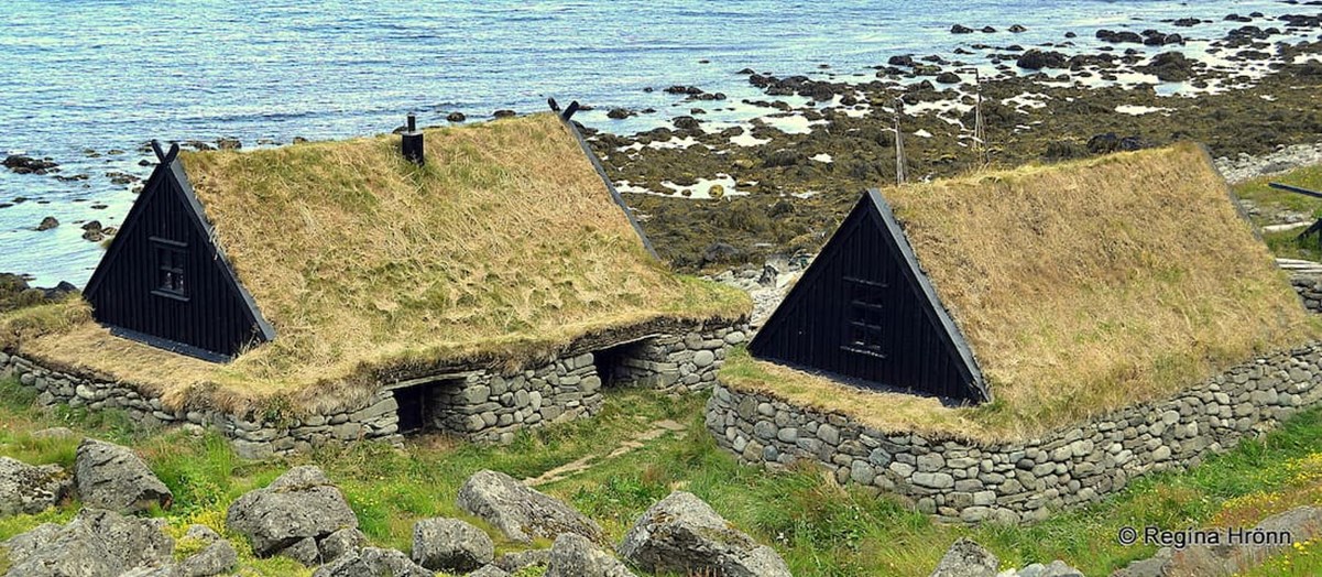
Ósvör maritime museum in Bolungarvík
This travel-blog is the last travel-blog in my series about the northern part of the Westfjords of Iceland. We have been driving on road 61, Djúpvegur, and visited many interesting spots on the way.
We are coming from Ísafjörður and Hnífsdalur in Skutulsfjörður fjord. We will now drive to Bolungarvík village and will be driving further on all the way to the top of Mt. Bolafjall.
The Maritime Museum Ósvör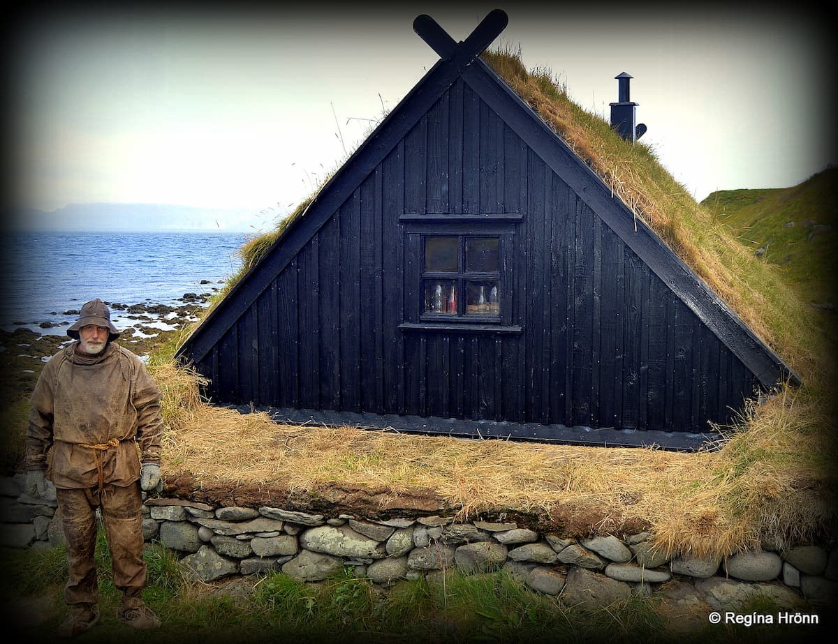
The curator of Ósvör maritime museum looks really authentic dressed in this way
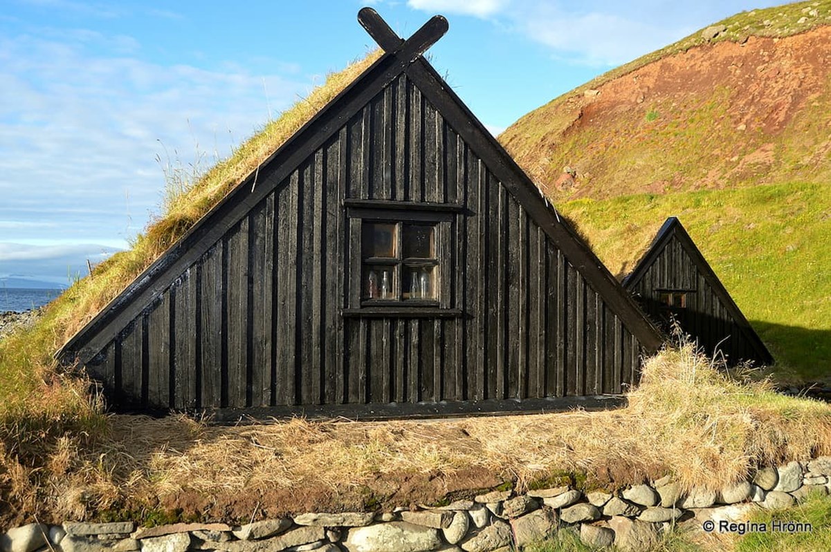
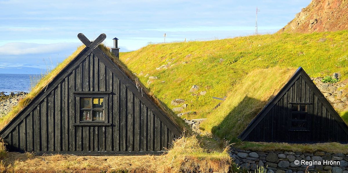
First, we are going to visit Ósvör Maritime Museum, which is a very popular photo stop as here you have idyllic turf structures - replicas of old fisherman's huts from the 19th century.
When you exit the Bolungarvíkurgöng (Óshlíðargöng) tunnel you will have passed Ósvör maritime museum, so you will have to drive back a short distance to visit the museum.
Whereas earlier on (until September 2010) when we drove on Óshlíðarvegur road, which is now closed for cars, then Ósvör museum would be on your right-hand side immediately by the road.
The Maritime Museum Ósvör
In 1988 there were only some walls left from the old fishing station from the age of the rowing boats. The inhabitants got a good idea to rebuild it in its original form to show us what Bolungarvík was like in the olden times.
Back then during the wintertime or "low season" on the farms, many people would go to the fishing stations by the seaside and live in such small fishing huts for several weeks and fish from open rowing boats.
This was done here in Bolungarvík from the settlement age and it became a fishing station very early on.
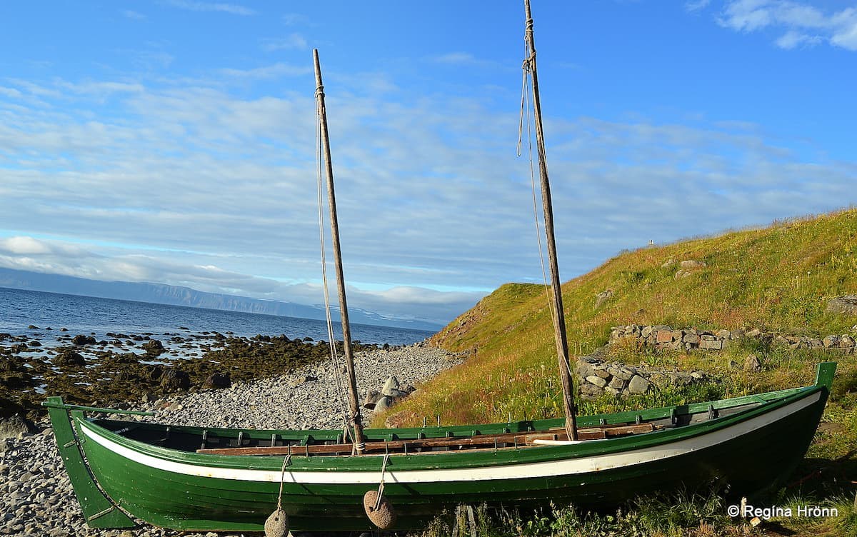
The six-oared boat, Ölver at the Ósvör maritime museum in Bolungarvík
At Ósvör you will also find a fish-drying hovel, much like the one I showed you in Vatnsfjörður - Hjallur. And a salt house.
Prominent is also the six-oared boat, Ölver, a typical fishing boat that the fishermen used in the 19th century.
Ölver was built in 1941 in the liking of the old rowing boats for the District and Maritime Museum of Ísafjörður and was the first showpiece for that museum (Neðsti.is).
In 1988 it was moved tó Ósvör to exhibit what it looked like in its natural surroundings.
Ósvör maritime museum in Bolungarvík
A documentary Verstöðin Ísland - 1. hluti: Frá árum til véla was shot here at Ósvör. It is in Icelandic but gives you a general idea of what it was like to be a fisherman here in the Westfjords.
The curator of the museum will greet you in traditional fishermen clothes, skinnklæði, a waxed skinsuit worn by the Icelandic fishermen at sea in the 19th century (you can see him in one of my photos, he was gracious enough to pose for me).
Check them out at Ósvör Maritime Museum.
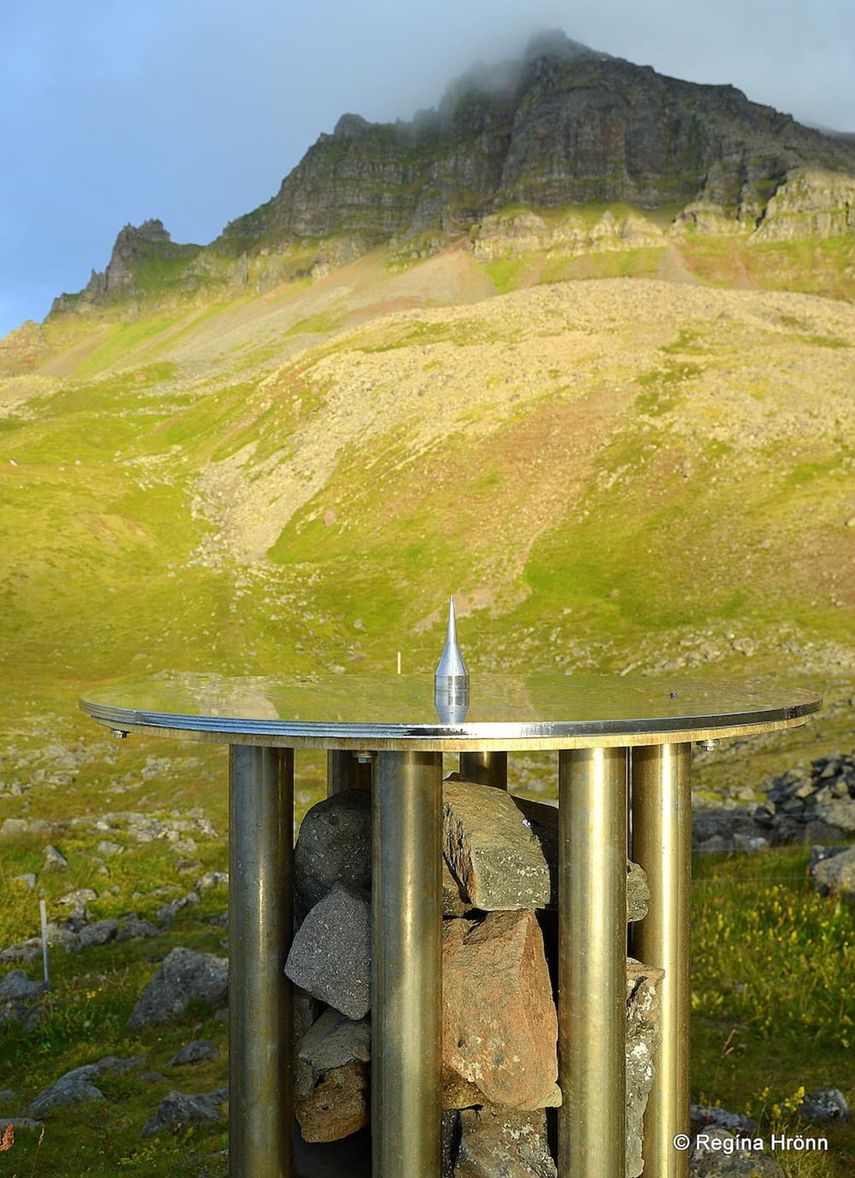
The View-dial in Bolungarvík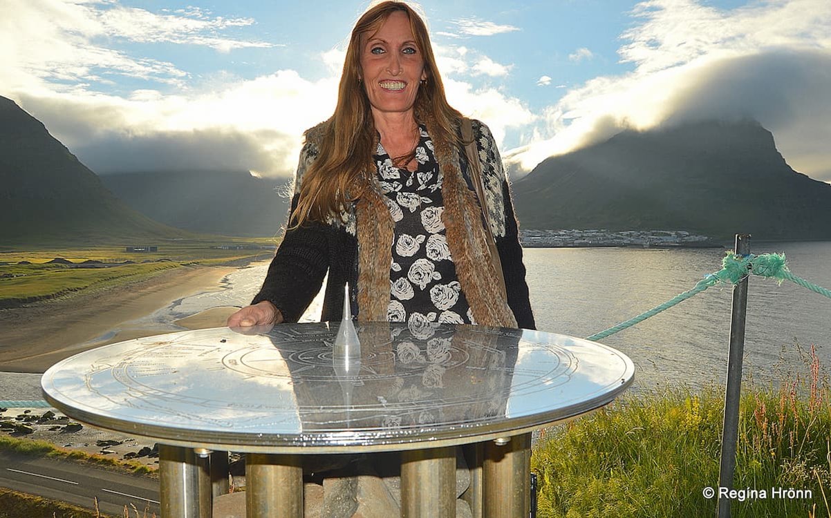
Blocking the sun with my head ;) Bolungarvík village in the background
Just above Ósvör at Óshólar, you will find one of the many view-dials in Iceland. My father-in-law, Jakob Hálfdanarson, and his family design view-dials and I look for them and always stop by them on my travels in my country.
There are 90+ view-dials in Iceland and we have visited and photographed the majority of them.
The designer of the view-dial at Óshólar was Jónas Guðmundsson, and Jón Sigurpálsson designed the pillar.
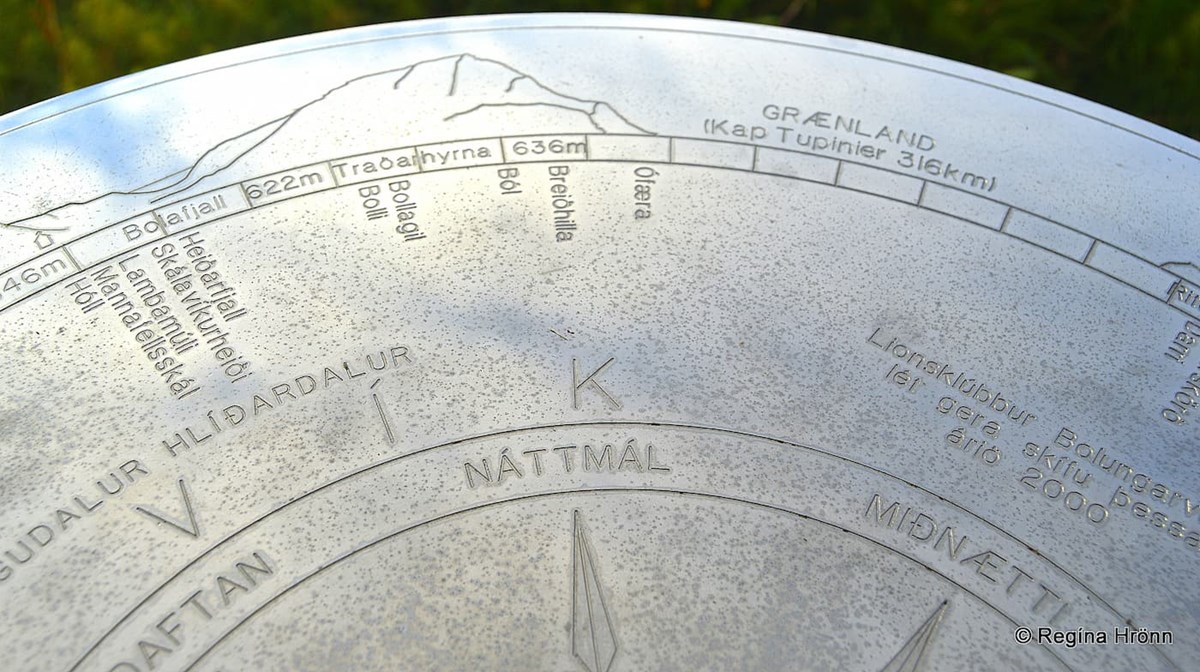
The chrome-plated copperplate
The view-dial was erected in 2000 by the Lions Club of Bolungarvík. It is a chrome-plated copperplate and shows the time of 3 hours and the names of the surrounding mountains.
You can even see in my photo above that Greenland is marked on the view-dial. It is 316 km away.
The pillar is so pretty - it is made of 8 pipes with 2 shelves. On the upper shelf are rocks from the mountains, and on the lower shelf are rocks from the shore.
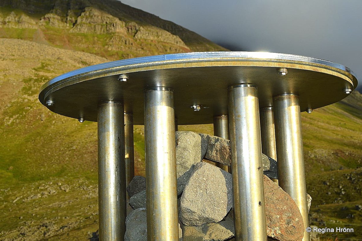
The rust-free pipes and the two types of rock
From the hill, even though it is not high up, there is a good view of the surrounding area.
Often the view-dials are on mountain tops, and I will show you the location of the 5 view-dials in the Westfjords in another travel-blog, one of which is on the top of a mountain.
The lovely village Bolungarvík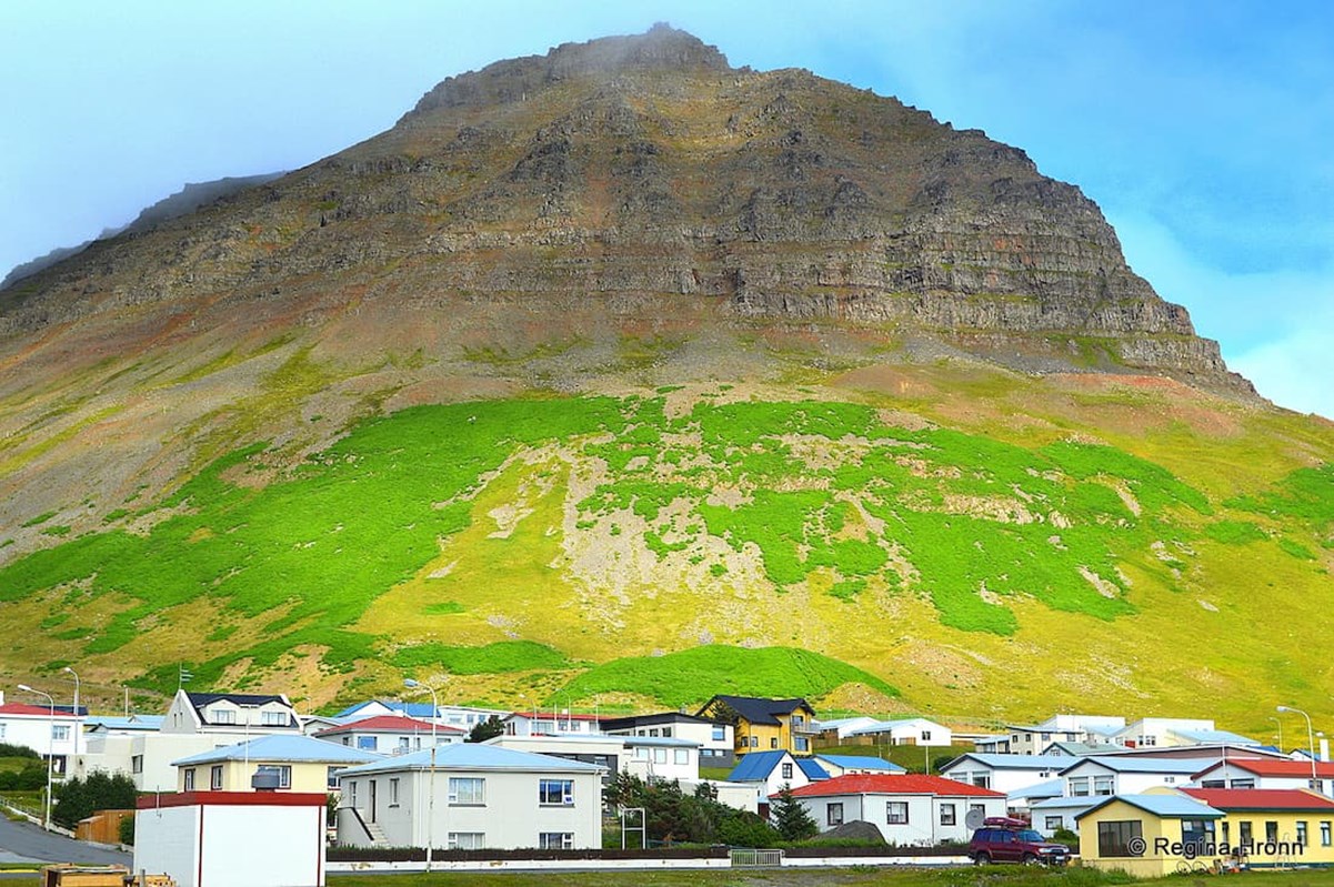
Mt. Traðarhyrna and Bolungarvík village
Bolungarvík village is a lovely fishing village with a population of approximately 922.
At the turn of the 20th century, a village started forming in Bolungarvík, and Bolungarvík got municipal rights in 1974.
Bolungarvík village
It is the northernmost built-up area in the Westfjords of Iceland, named after the cove by which it stands.
As in Hnífsdalur 2 of the mountains are called -hyrna. Here in Bolungarvík, we have Mt. Traðarhyrna and Mt. Óshyrna.
You can see Mt. Traðarhyrna in my photo above.
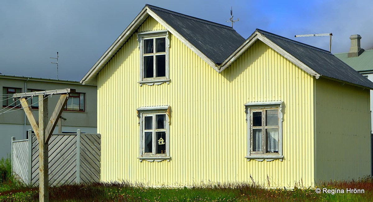
I am a fan of yellow houses and saw cute old yellow house in Bolungarvík village
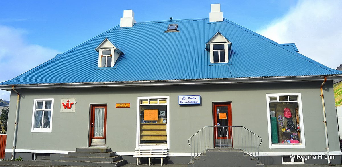
As in all the villages of Iceland, there is a church in Bolungarvík.
The church is called Hólskirkja, not Bolungarvíkurkirkja as one would have expected. It is located by the old manor Hólar.
Hólskirkja is a timber church built in 1908. It was designed by the noted architect Rögnvaldur Ólafsson, who is referred to as the first Icelandic architect.
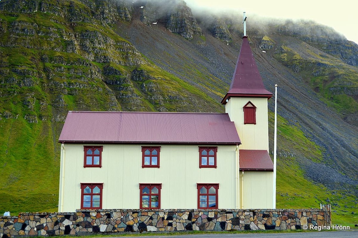
Hólskirkja church
Two big church bells are in Hólskirkja, dating back to 1620 and 1775. They are large as they protect the inhabitants from ghosts on the Skálavíkurheiði heath.
Where we will be heading, by the way, in a short while ;)
Grjóthlað memorial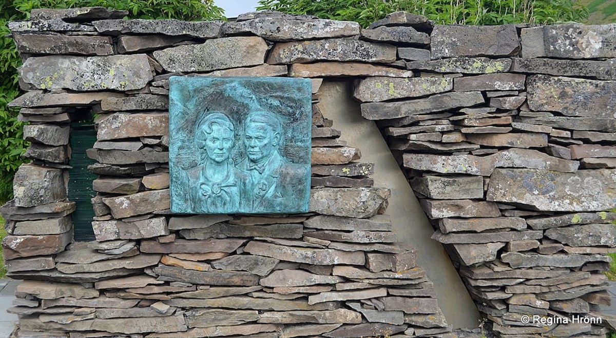
Grjóthlað memorial
In Bolungarvík you will notice the monument Grjóthlað. It is a memorial erected to honour Einar Guðfinnsson, fishing operator (útgerðarmaður). Einar was the first person to become an honorary citizen of Bolungarvík.
Einar was not born in Bolungarvík but in the turf house Litlibær in Skötufjörður in 1889.
But Elísabet Hjaltadóttir, the wife of Einar, was born here in Bolungarvík.
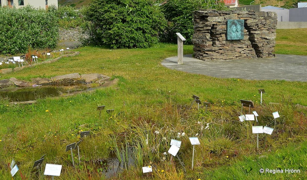
Westfjord's Botanical Garden in Bolungarvík
The memorial, which was erected in 1998 was made by Jón Sigurpálsson. The stones were selected in Skötufjörður and built in the liking of the stone fences by Litlibær.
You can see the similarities in my travel-blog: Litlibær Turf House on the Hvítanes Peninsula in the Westfjords of Iceland - a Cute little Turf House Café
Next to the memorial Grjóthlað, you will find Grasagarður Vestfjarða - the Westfjord's Botanical Garden.
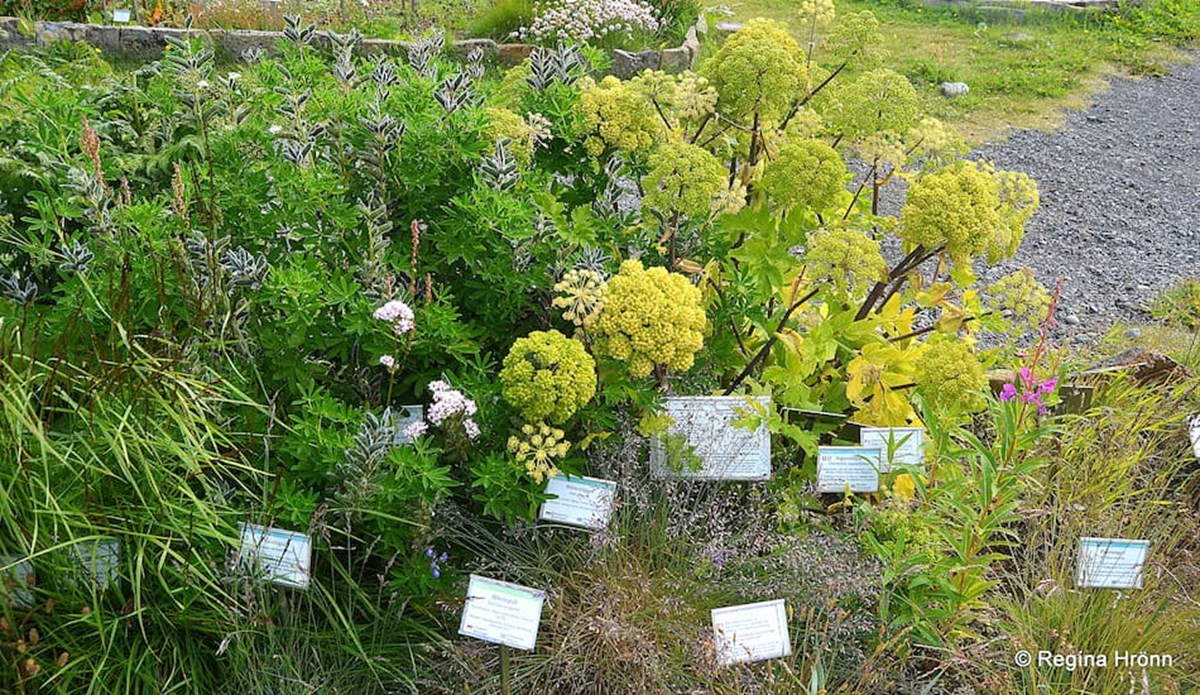
Westford's Botanical Garden in Bolungarvík
The botanical garden was opened in 2010 and contains many different plants from Iceland and especially from the Westfjords of Iceland. The plants are marked in Icelandic, Latin, German, and English.
The memorial and the botanical garden are located by Félagsheimili Bolungarvíkur in Aðalstræti street.
The avalanche barriers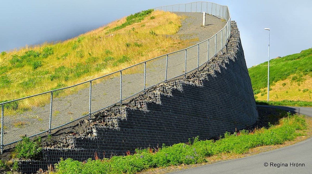
The avalanche barriers in Bolungarvík
The avalanche barriers (walls) protect the inhabitants from avalanches in the wintertime, but avalanches are frequent here in the Westfjords, as I told you about in my previous travel-blogs about Súðavík village and Hnífsdalur village, where there have been avalanches with many fatalities.
The mountains in Bolungarvík are tall and scree-sloped, and the avalanche barriers in Bolungarvík protect the inhabitants of the village from avalanches in Mt. Traðarhyrna.
You will see such avalanche barriers in many villages in Iceland.
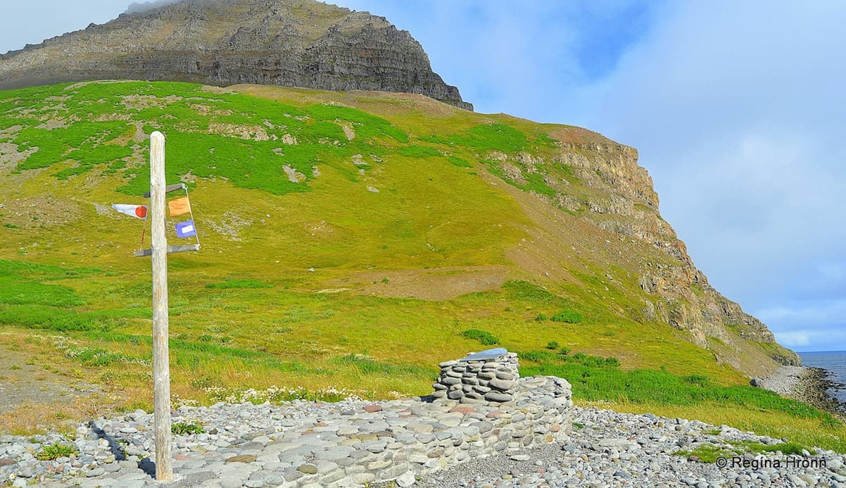
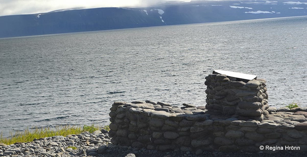
The Memorial for QP-13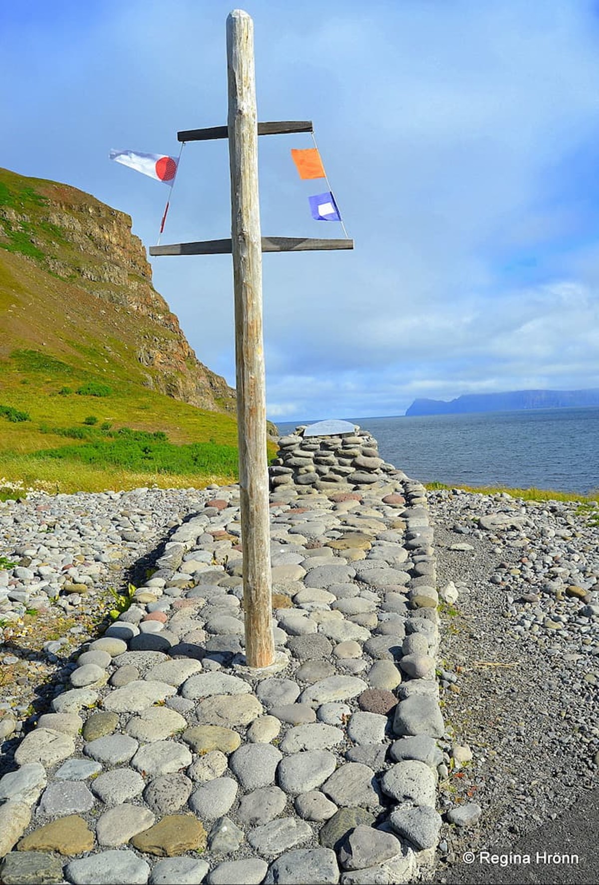
The Memorial for QP-13 in Bolungarvík
Next to the avalanche wall, you will find a memorial in memory of the nearly 240 men, women, and children who perished in the greatest marine disaster in Iceland.
Written on the memorial plaque is "... The tragedy occurred off Straumnes point on July 5th, 1942, when 19 ships from the convoy QP-13 bound for Hvalfjord (Hvalfjörður) from Murmansk in Northern Russia encountered inclement weather and ran into an allied minefield intended to deter German warships.
The Memorial for QP-13 in Bolungarvík
The ships lost were the British naval vessel HMS NIger; American merchant ships SS Heffron, SS Hybert, SS Massmar, and SS John Randolph; and the Russian ship SS Rodina.
The American ship SS Exterminator was extensively damaged but made the port of Hvalfjord. The wrecks of the ships rest at a depth of 70 meters, 53 kilometers north of here.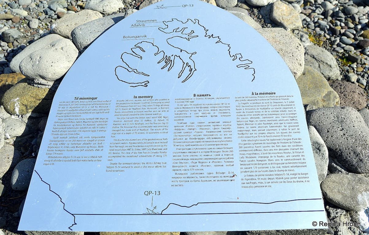
The Memorial for QP-13 in Bolungarvík
The disaster also marked one of the greatest rescue feats in Icelandic waters.
Approximately 260 people were rescued from the rough sea and treacherous magnetic mines by the small escort ships HMT St. Elstan, HMT Lady Madeleine, and FFL Roselys.
The Memorial for QP-13 in Bolungarvík
The crew of the Free French Corvette Roselys accomplished the exceptional achievement of saving 179 souls.
Despite the imminent danger, the 40-ton fishing boat Vébjörn IS-14 ventured to assist in the rescue efforts but found no survivors.
Völuspá - Prophecy of the Seeress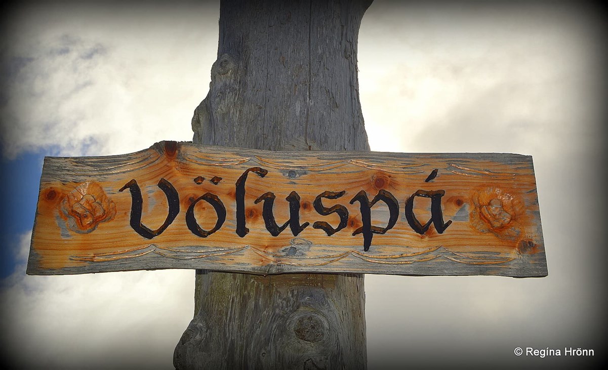
In Bolungarvík village you will see the artwork Völuspá
Bolungarvík has been inhabited since the settlement of Iceland and the settler in Bolungarvík was the settler woman Þuríður sundafyllir - Þuríður the Channel Filler in around 950. She was a latecomer, as it were, as the first settler, Ingólfur Arnarson, arrived in 874, give or take a few years.
Written in Landnáma - Iceland's Book of Settlements is: " Þuríður sundafyllir and Völu-Steinn her son, left Hálogaland (Norway) and lived in Vatnsnes (in Syðridalur).
She got the nickname "sundafyllir" or the Channel Filler as in hard times in Hálogaland she conjured that every channel would be filled with fish."
Völuspá in Bolungarvík
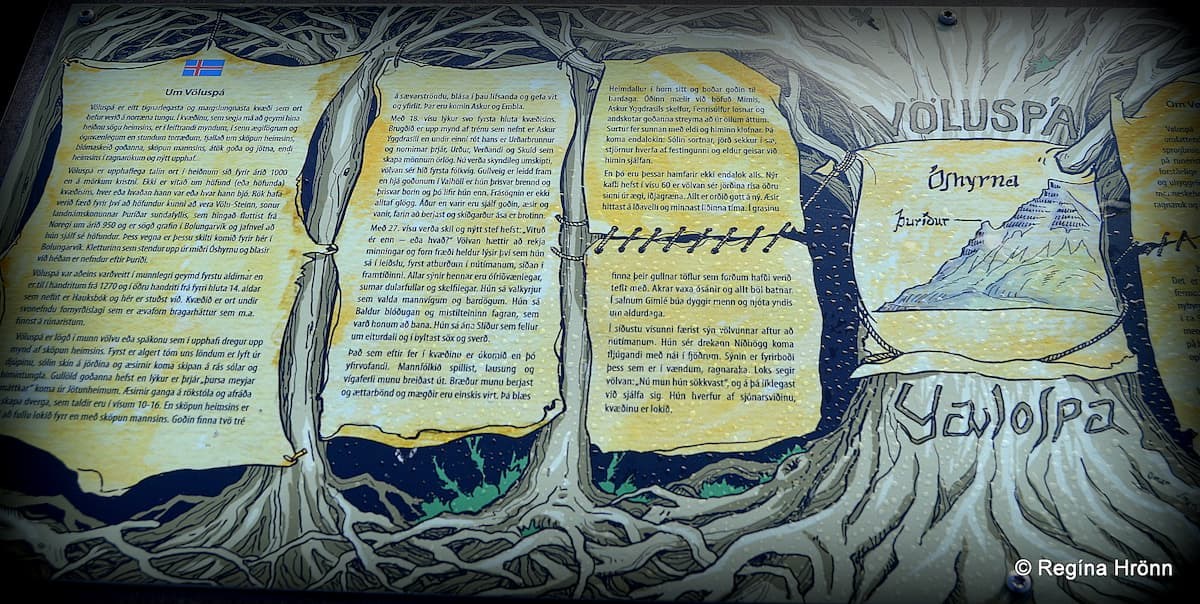
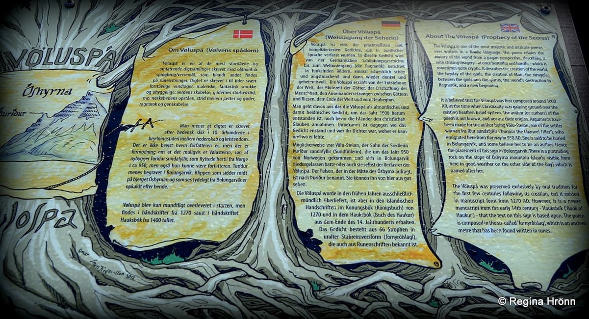
In Bolungarvík village you will find artwork called Völuspá - Prophecy of the Seeress.
Völuspá is the most majestic poem written in a Nordic language. It is believed that Völuspá was composed around the year 1000 when the conversion to Christianity took place in Iceland.
Völuspá tells the story of the creation of the world from a heathen perspective, the creation of man, the Norse gods, and their struggles, the destruction of the world in Ragnarök, and a new beginning.
Völuspá in Bolungarvík Westfjords of Iceland
Völuspá consists of 67 stanzas and starts where the Völva asks Óðinn if he wants her to recite old lore.
The author is not known but some say that Völu-Steinn, the son of Þuríður sundafyllir was the author. Others argue that Þuríður herself was the author of Völuspá, but nobody knows for certain who the author was.
The protruding rock Þuríður in Mt. Óshyrna - photo taken from Óshólar by the view-dial
Thus this artwork Völuspá has been put up here in Bolungarvík village.
A protruding rock on Mt. Óshyrna is named after Þuríður.
Mt. Bolafjall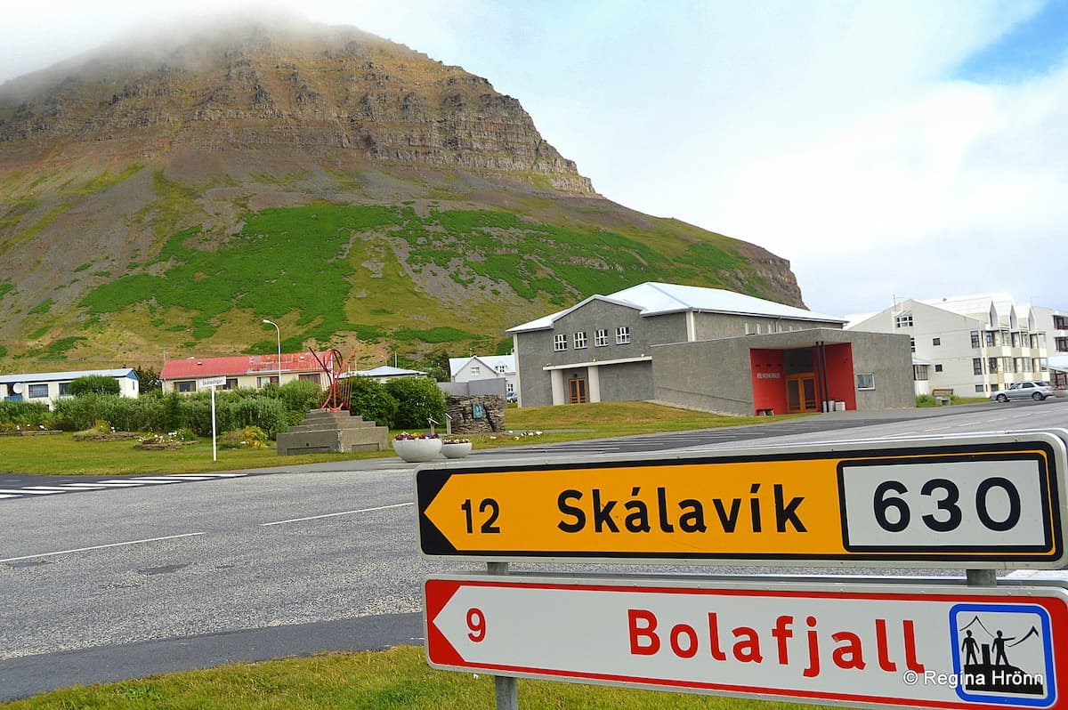
The sign says Bolafjall and Skálavík - Mt. Traðarhyrna is the mountain in my photo
Behind Mt. Traðarhyrna above the village Bolungarvík is Mt. Bolafjall, a mountain with a great view from the top.
We saw the road sign in my photo above with the sign for view-dials (the two men with a view-dial between them) and we wanted to have a look at it. See also a travel-blog I wrote: The beautiful View-dials - Hringsjár - in the Westfjords of Iceland.
We found no view-dial on top of the mountain though but maps with the names of the mountains.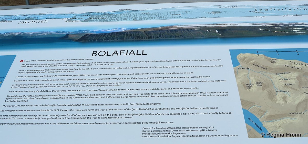
Maps on top of Mt. Bolafjall
A gravel road takes you to the top of the mountain in the summertime. The road is a bit steep like many of the Westfjord roads, but nothing major. The summit is 625 meters above sea level.
I must say though, that I am never at ease driving up mountains, whereas my husband is a bit of a daredevil and loves dragging me kicking and screaming up steep mountains ;)
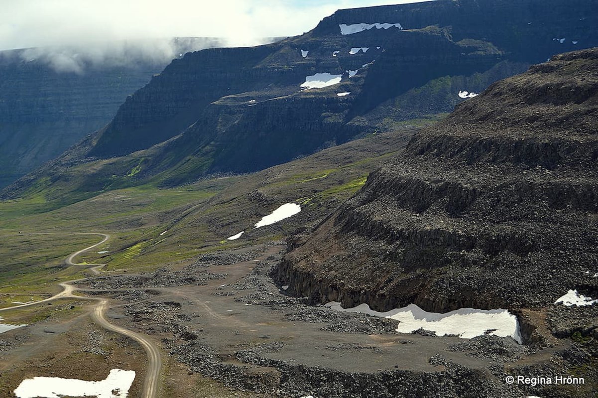
The road leading to Mt. Bolafjall in Bolungarvík
On top of Mt. Bolafjall, you will find a NATO radar station, one of 4 stations built in 1985-1988 and taken into use in 1992. The road was built on that occasion.
The radar station is now operated by Landhelgisgæslan, the Icelandic Coast Guard. From here they survey and control air traffic across a radius of up to 460 km.
A new observation platform is being erected on the top of Mt. Bolafjall (2021) as there is a great view from the top. The only view which we got though was from the road leading up to the top of the mountain.
I have seen a TV program about the new observation platform and I am sure that it is going to be a huge attraction. You can see photos on Google. I cannot wait to visit it next summer (2022).
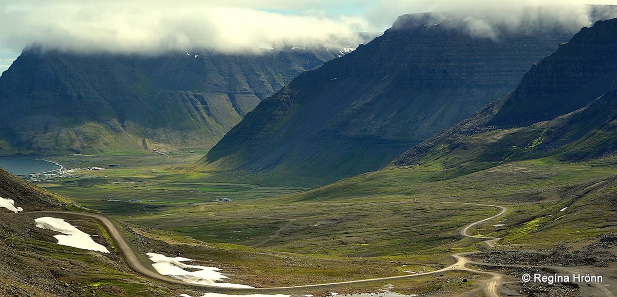
The road leading to Mt. Bolafjall in Bolungarvík
As soon as we reached the top of Mt. Bolafjall the clouds decided to lower themselves on top of the mountain, so we didn't see a thing.
This is the view we got (see my photo below)! And I didn't feel at ease being so high up without knowing where the mountain edges were so I stayed in the car while my husband went looking for the view-dial.
In the photo below you can see him running away from the maps towards the car. The drawing on the sign didn't help ;)
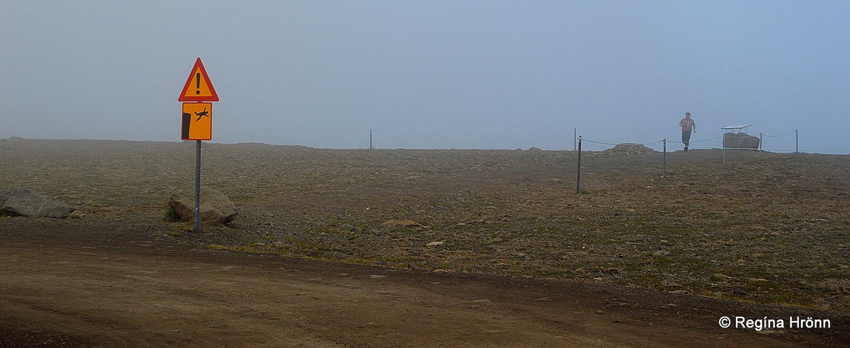 My husband on top of Mt. Bolafjall in the fog!
We quickly descended the mountain and decided to give it another go on our next visit to the Westfjords.
My grandmother and her 6 sisters and 1 brother were born at Ingjaldssandur in the Westfjords not so far from here.
But I have only got 2 relatives left in the Westfjords, 2 brothers who are my mother's cousins, all the others have moved away. Most of them now live in Eyjafjörður fjord up north and in Reykjavík, the capital city of Iceland.
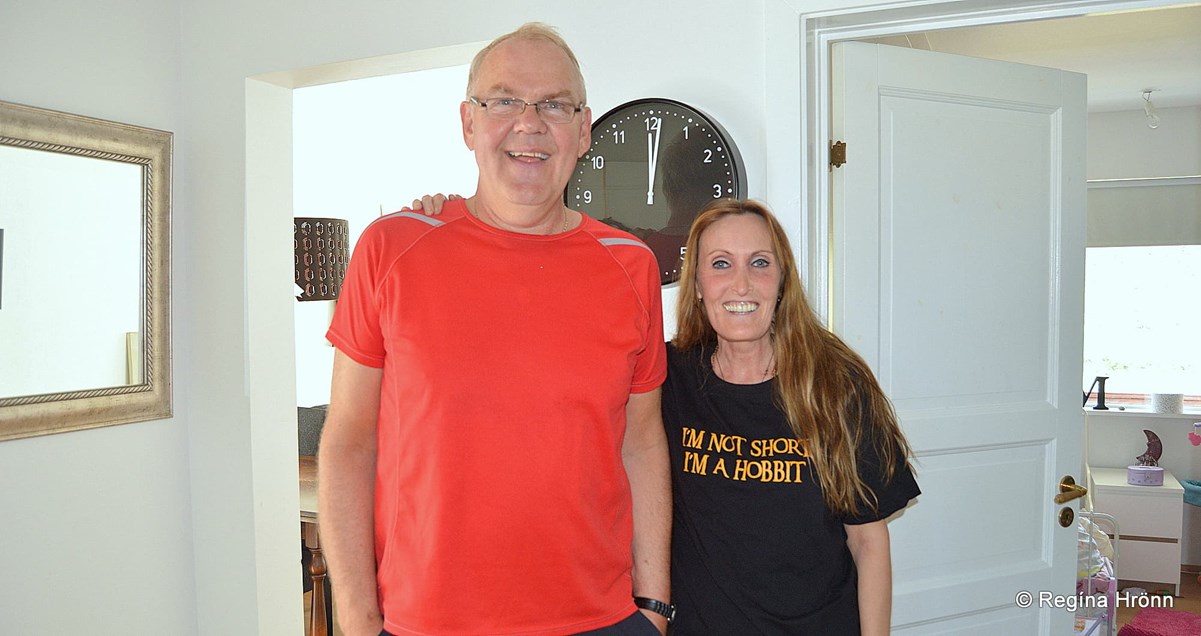
With Guðmundur (Mummi) my mother's cousin in Bolungarvík
I met up with my relative Guðmundur during my visit and stayed over at his daughter's place, who has by now moved away to the southwest corner of Iceland.
After exploring Bolungarvík we continued visiting the rest of the Westfjords on road 60 and many byroads. I have written many travel-blogs about our southbound journey, as there are so many beautiful attractions on that route.
Here is the location of Bolungarvík on Google Maps.
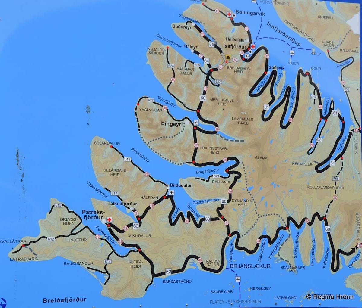 A map of the Westfjords
The travel-blogs I have written in chronological order about the northern part of the Westfjords are:
A lovely Visit to Reykjanes in the Westfjords
Vatnsfjörður in the Westfjords - the Viking Estate and Grettisvarða Cairn
Litlibær Turf House on the Hvítanes Peninsula in the Westfjords - a Cute little Turf House Café
Watching the cute Seals at Hvítanes Peninsula in the Westfjords
Visiting Súðavík Village and Langeyri in Álftafjörður in the Westfjords
A Delightful Visit to Ísafjörður - the Capital City of the Westfjords
Hnífsdalur village in the Westfjords and the big Avalanche in 1910
Visiting Bolungarvík Village - the End of Road 61
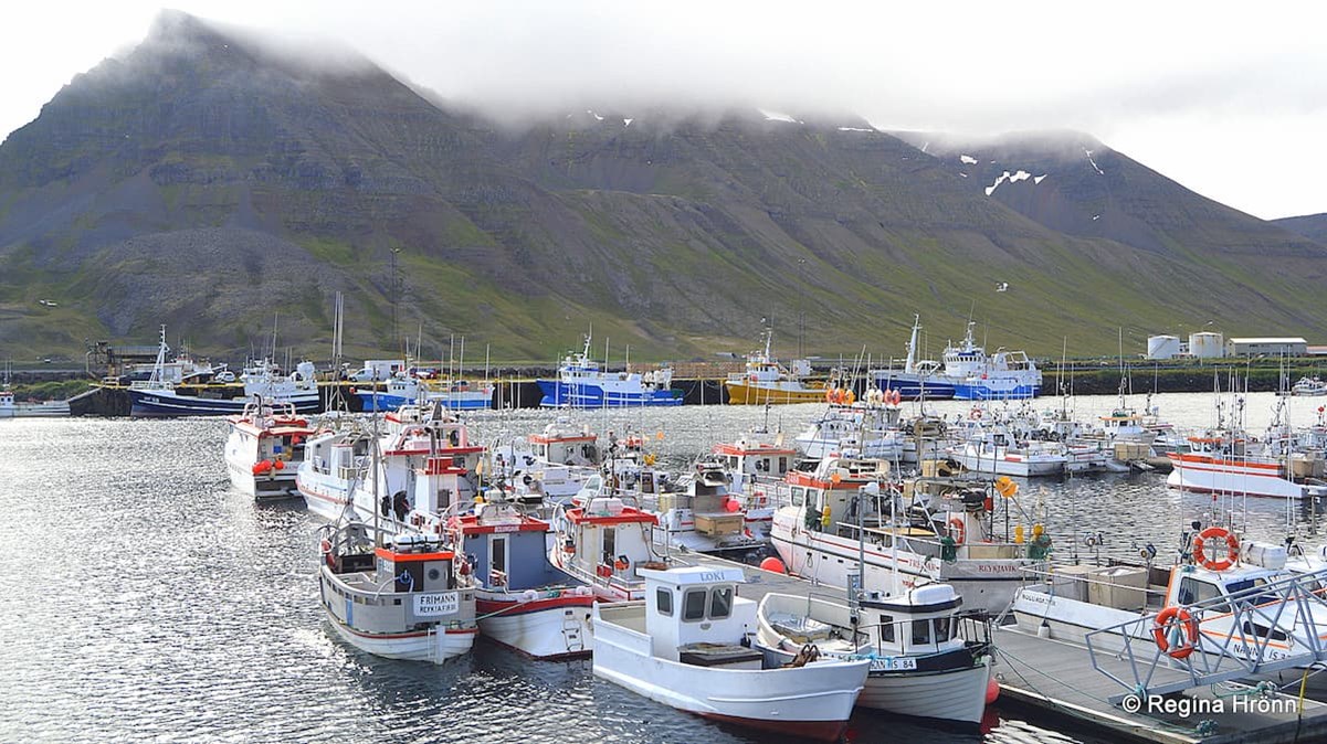
Bolungarvík harbour
I hope you have enjoyed travelling with me on road 61, Djúpvegur, on the northern part of the Westfjords :)
In my next travel-blog I am going to show you a detour I made from road 61 to Drangajökull glacier, the northernmost glacier in Iceland: A beautiful Hike to Drangajökull Glacier in the Westfjords of Iceland.