The beautiful View-dials - Hringsjár - in the Westfjords of Iceland
The view-dial at Óshólar - using my head to block the sun
In my last series of travel-blogs, I have been showing you what there is to see and do by road 61, Djúpvegur, on the northern part of the Westfjords of Iceland.
In this travel-blog, I want the show you the 5 view-dials in the Westfjords which I have visited, their location, what they look like, and the view from them.
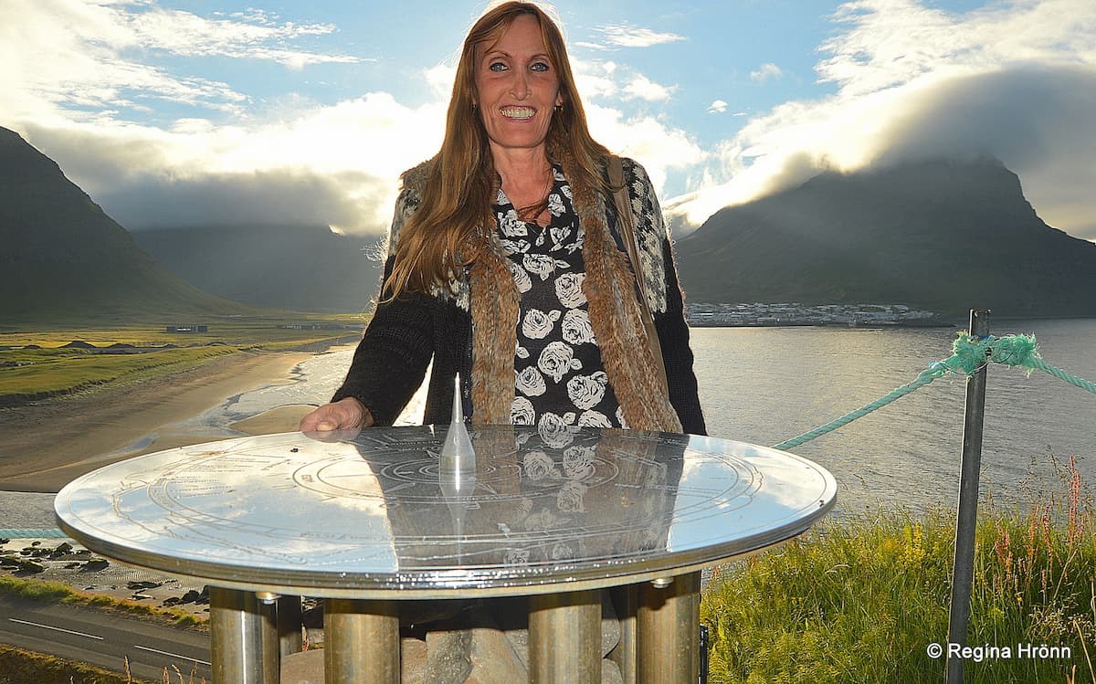
The view-dial at Arnarnes
There are 90 plus view-dials in Iceland and I have often been asked to write a travel-blog about their locations. I will start by showing you the view-dials in the Westfjords of Iceland.
There are 8 view-dials in the Westfjords: in Flatey island, at Reykhólar, at Flateyri, on top of Mt. Sandafell, in Bolungarvík, in Hornstrandir, on Arnarnes and on Kambsnes (which I missed by a month or so).
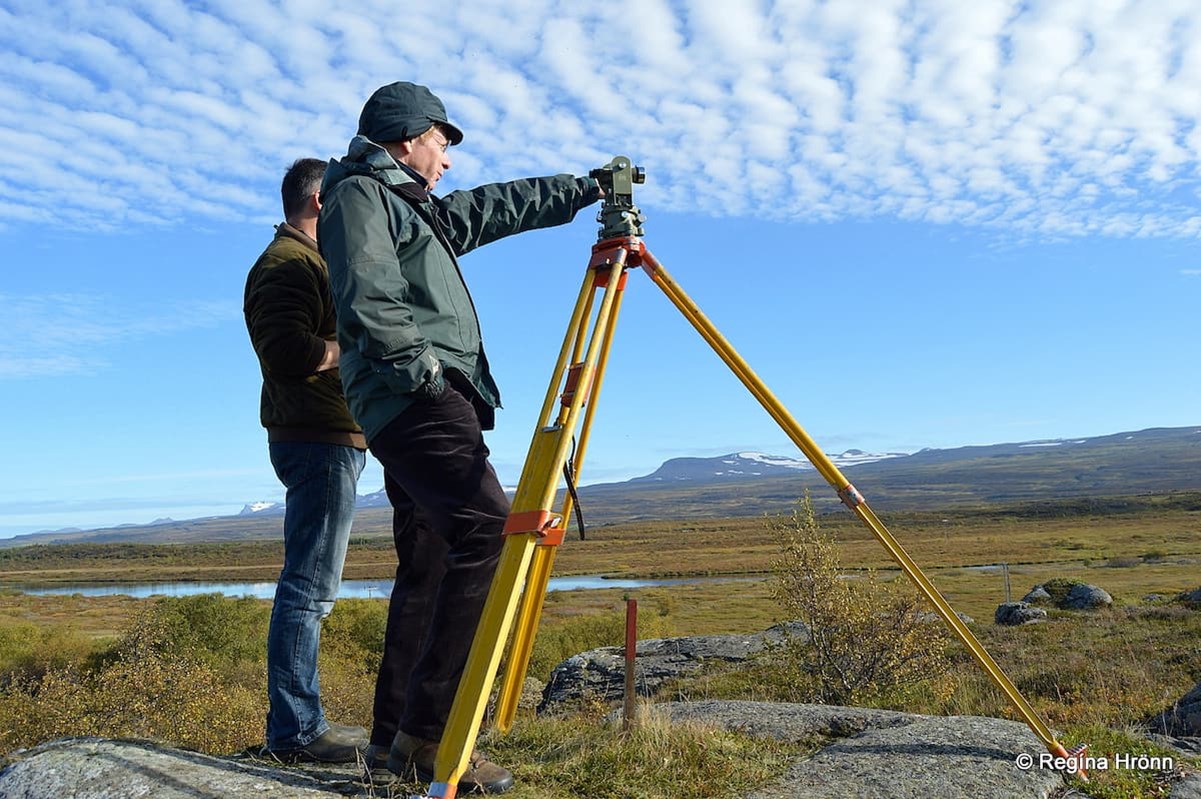
My father-in-law, Jakob Hálfdanarson, measuring for a view-dial in East-Iceland
I got the information about the view-dials in a booklet about view-dials in Iceland, which my father-in-law, Jakob Hálfdanarson, made for his personal use.
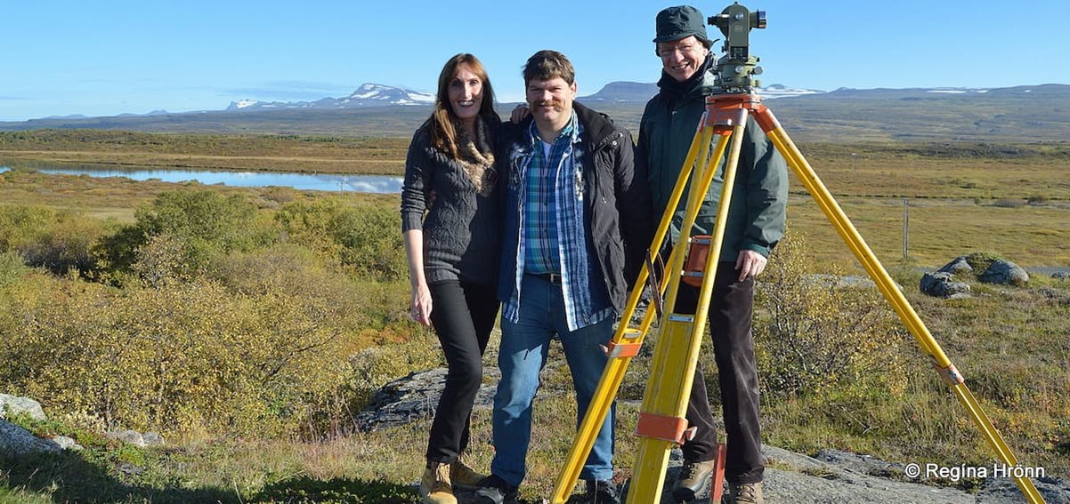
The view-dials in Iceland are of special interest to me as my father-in-law, Jakob, together with his family, my sister-in-law, Þórný, and my husband, Jón Víðis, designs view-dials.
With my husband and father-in-law measuring for view-dials
I got to join my husband and my father-in-law on one of their work trips when they were measuring for a view-dial at Eiðar in East-Iceland :)
My father-in-law's uncle, Jón J. Víðis, surveyor (my husband's namesake), was the instigator for designing the view-dials in Iceland. He designed the first one, which was erected in 1938 on Valhúsahæð hill in Seltjarnarnes in the Great Reykjavík area (see my photo below).
That view-dial was erected by Ferðafélag Íslands - the Touring Club of Iceland, but they have erected 15 view-dials in Iceland.
The first view-dial in Iceland on Valhúsahæð hill was erected in 1938 - looking east towards Reykjavík
Jón J. Víðis, who designed 23 view-dials from 1935-1974, was born in 1894 in the beautiful turf house at Þverá in Laxárdalur in North-Iceland.
A memorial was erected in the memory of Jón in Laxárdalur valley. You can read more about him in my Þverá travel-blog.
Coincidently, Jón surveyed the roads in the Westfjords which at that time proved to be a turning point in road construction in Iceland.
The first view-dial in Iceland on Valhúsahæð hill was erected in 1938 - looking west
As a surveyor, Jón needed two assistants. Often Jón employed his nephews and great-nephews, including my father-in-law, Jakob, who later took over Jón's project of designing view-dials when Jón Víðis died in 1975.
From 1960 Jakob had assisted Jón Víðis with 11 view-dials around Iceland. And Jakob designed his first view-dial in 1970.
Now that I have told you about Jón J. Víðis, my father-in-law, Jakob, and the first view-dial in Iceland, it is time to show you the view-dials in the Westfjords of Iceland ;)
The view-dial in Flateyri
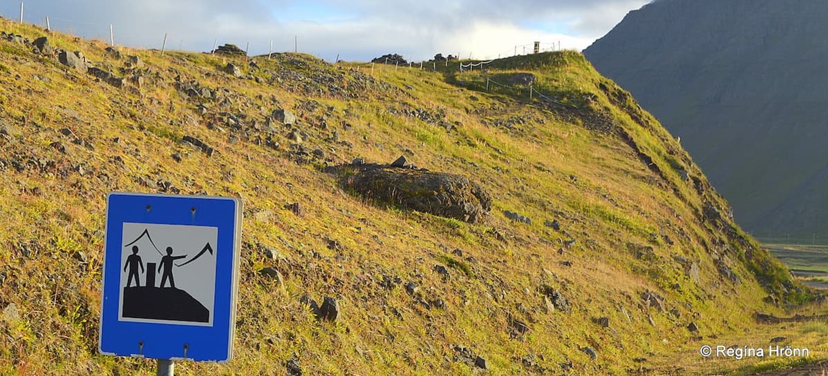
To find the view-dials in the Westfjords, be on the lookout for the sign below; 2 men with a view-dial between them, that is the sign for view-dials.
I have too often seen this sign used for an observation platform though, i.e. a spot from which the view is good. But another sign, similar to the view-dial sign, should be used on that occasion.
The view-dial sign and the view-dial at Óshólar in the distance
Also, be on the lookout for the sign with "útsýnisskífa" or "hringsjá" written on it, which are the Icelandic terms for a view-dial.
Let us start by driving clockwise on the southern part of the Westfjords region, and visit the view-dials in chronological order.
The View-Dial at Hellishólar in Reykhólar
The view-dial at Hellishólar looking south
Now, let's have a look at the view-dial at Reykhólar in the southern part of the Westfjords region.
There is a view-dial at Hellishólar hill in Reykhólar village.
The view-dial shows the names and height of the mountains and the time of three hours. The pillar is a basalt column on a molten platform with a railing.
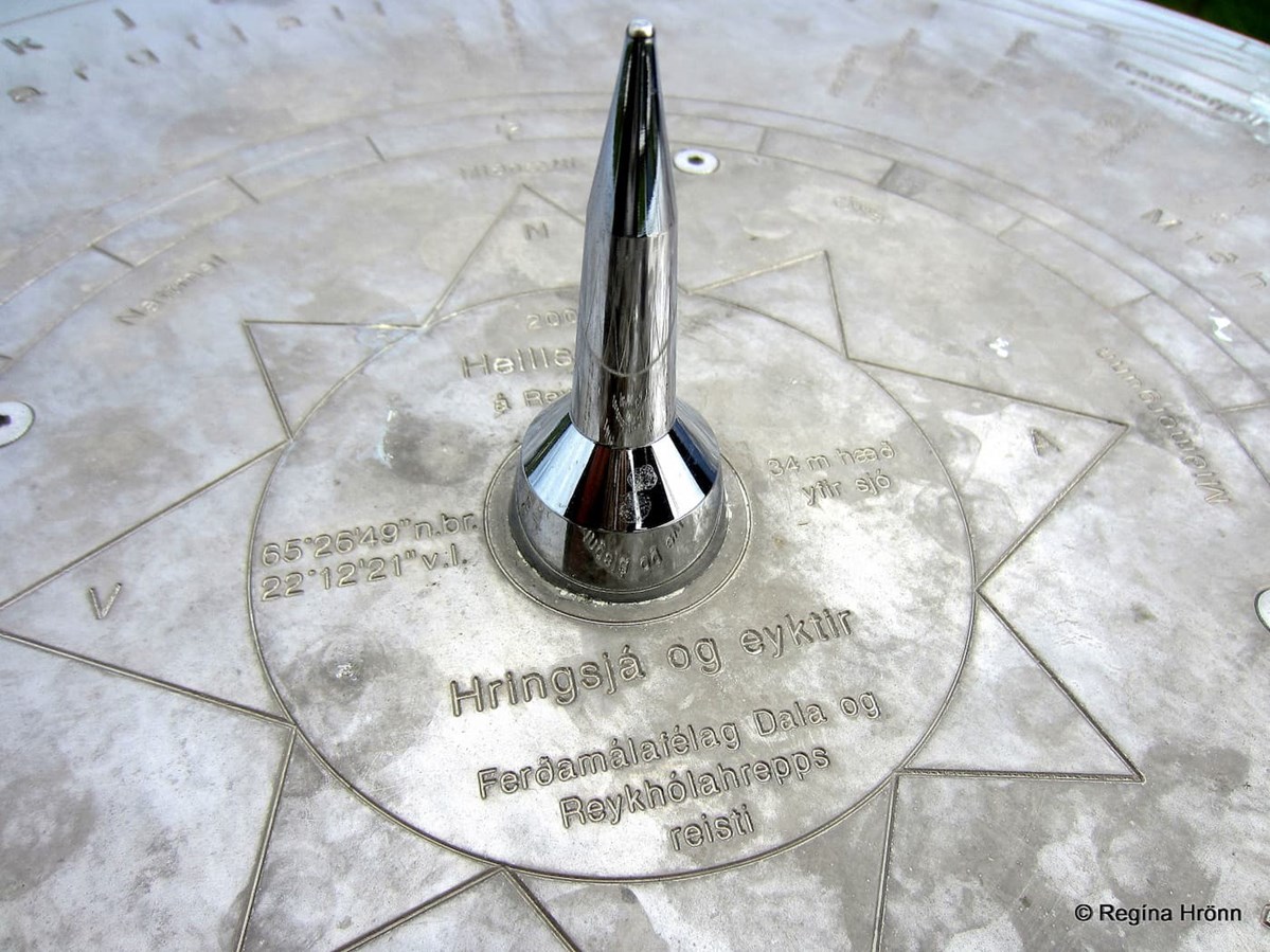
The view-dial at Hellishólar
The view-dial was erected in 2007 by Ferðamálafélag Dala og Reykhólahrepps. It was designed by Jakob Hálfdanarson and his assistants were his children Þórný and Jón Víðis.
When my husband took me on our first trip before we even started dating we stayed at Reykhólar on our way to Dynjandi waterfall.
He showed me the view-dial at Hellishólar, and told me that his father had designed it and that he had helped him when they were measuring the view.

My husband by the view-dial at Hellishólar back in 2013, showing me how to use view-dials
And he showed me how to find out the names of the mountains by using a pen.
What he didn't know is that I was already interested in view-dials and had visited many of them on my travels in Iceland and photographed them :)
So now we have a common interest in searching for view-dials in Iceland and photographing them.
He always wants one photo of me standing by the view-dial to show the height of the pillar. As the height of the pillars varies a lot.
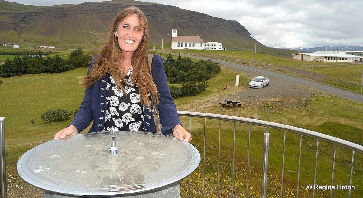
The view-dial at Hellishólar - Reykhólakirkja church in the background
The view from Hellishólar is wonderful - on the east side, you can see as far as Gilsfjörður and Skarðsströnd and the Snæfellsnes peninsula.
To the west, you can see Barðaströnd and the sea view between Mt. Stálfjall and Snæfellsjökull glacier is of Breiðafjörður fjord with its countless islands.
The Breiðafjörður islands are one of 3 innumerable locations in Iceland. On one of the islands, Flatey island, is also a view-dial that was erected in 1996. We stayed in Flatey for one night, but the view-dial was so dirty that I didn't take a photo of it.
We usually bring wet tissues with us to clean the bird droppings from the view-dials before we photograph them, but in this case, the Arctic terns had really gone to town!
The view-dial at Hellishólar looking south
Later on, when my husband and I were married, we stayed at Reykhólar for 3 days and I have written 3 travel-blogs about our stay. There is so much to see and do in this area, which I recommend visiting.
Many travellers continue driving on road 60, but turning on road 607 will take you to Reykhólar, where you will f.ex. be able to visit a geothermal area, and Lómatjörn - The Pond of the Loons, so it is well worth the detour.
I took a video of a choir of loons singing on the Pond of the Looms at Reykhólar:
Let's return back to road 60 and follow that road through the many southern fjords of the Westfjords until we reach Vatnsfjörður fjord, where we continue driving on road 60 over the heaths, Dynjandisheiði and Hrafnseyrarheiði heaths.
Now we can also drive the new tunnel which opened in 2020, and is now road 60) until we reach Dýrafjörður fjord.
Note that there are 2 Vatnsfjörður fjords in the Westfjords - I have shown you the archaeological site at Vatnsfjörður on the northern part in another travel-blog.
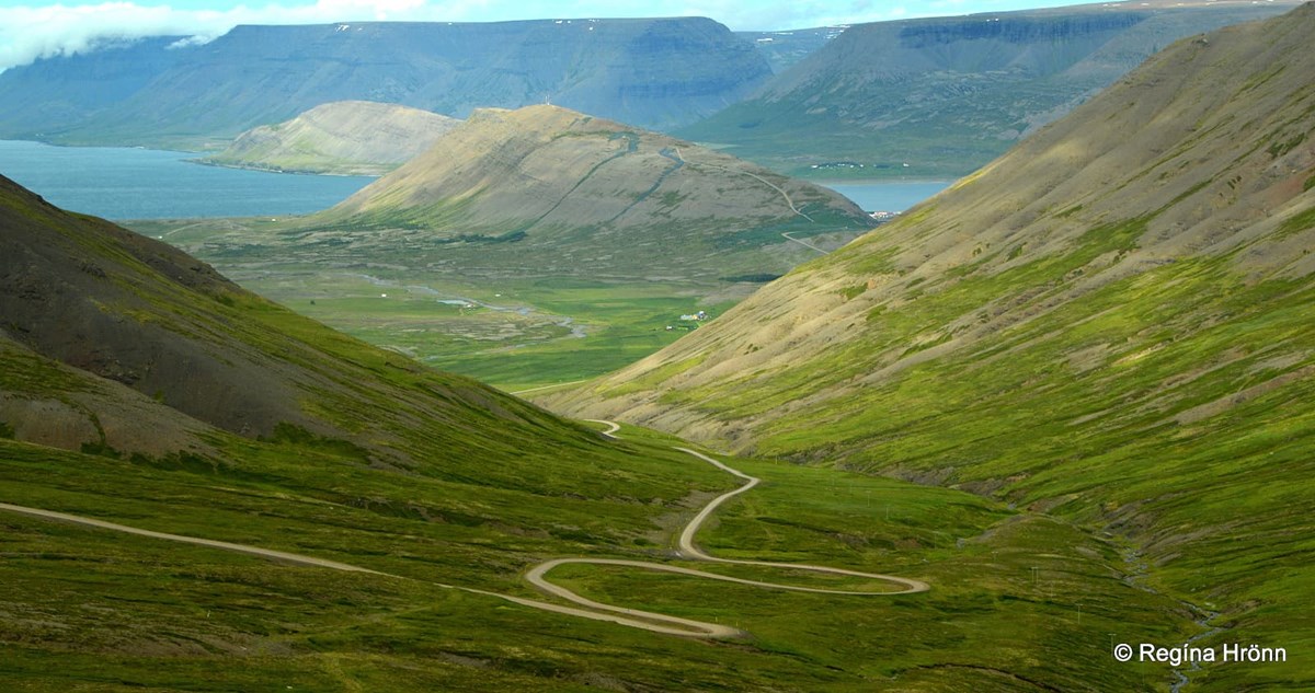
Driving over Hrafnseyrarheiði heath - Mt. Sandafell in the middle of the photo
If you take the new tunnel, when exiting instead of driving across the fjord via road 60, take road 622 and 626 for Þingeyri village and Mt. Sandafell.
The View-Dial on Mt. Sandafell 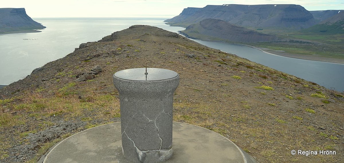
The view-dial on Mt. Sandafell is almost on the edge of the mountain
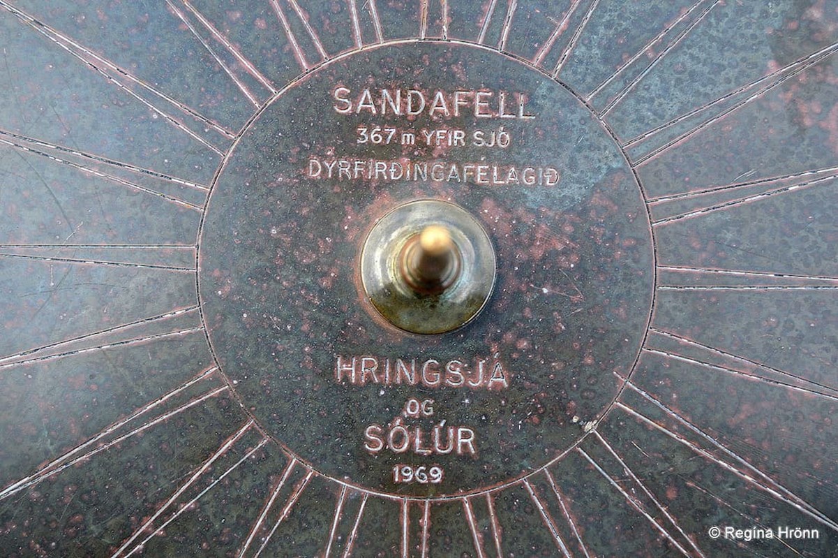
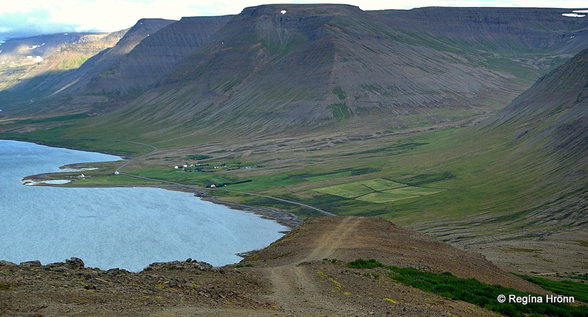
You will find a view-dial on top of Mt. Sandafell above Þingeyri village in Dýrafjörður fjord. The mountain is not very tall, only 367 meters above sea level, but from the top, there is a breathtaking view.
The view-dial on top of Mt. Sandafell is the only view-dial, which I visited in the Westfjords, that is on top of a mountain.
But only a short hike is needed as the steep road leads almost to the top. Well, it leads to the top, but park your car in a parking spot and hike to the top.
The view-dial on Mt. Sandafell
I am not very keen on driving to mountain tops but humoured my husband as his mind is set on seeing all the view-dials in Iceland.
But he took it a bit far last year when he drove to the top of Mt. Geitafellshjnúkur (430 meters above sea level) in Reykjahverfi in North-Iceland to see the view-dial on top of the mountain.
The road was absolutely dreadful and I was so scared that I wanted to crawl on my hands and feet down the mountain!
The view-dial on Mt. Sandafell
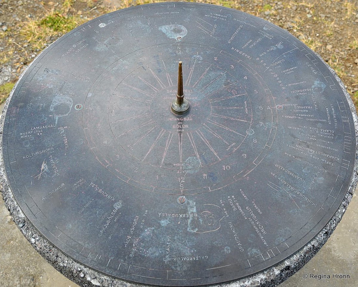
Now, back to Mt. Sandafell. The mountain is named after the old manor Sandar, thus the name Sandafell. There is another mountain in the east called Sandfell, meaning Sandy Mountain.
The view-dial was erected in 1969 by Dýrfirðingafélagið. It was designed by Jón. J. Víðis, with the help of Jakob Hálfdanarson, and Már Viðar Másson (Jón's great-nephew).
The view-dial is also a sundial (sólúr). The pillar is molten, relatively low.
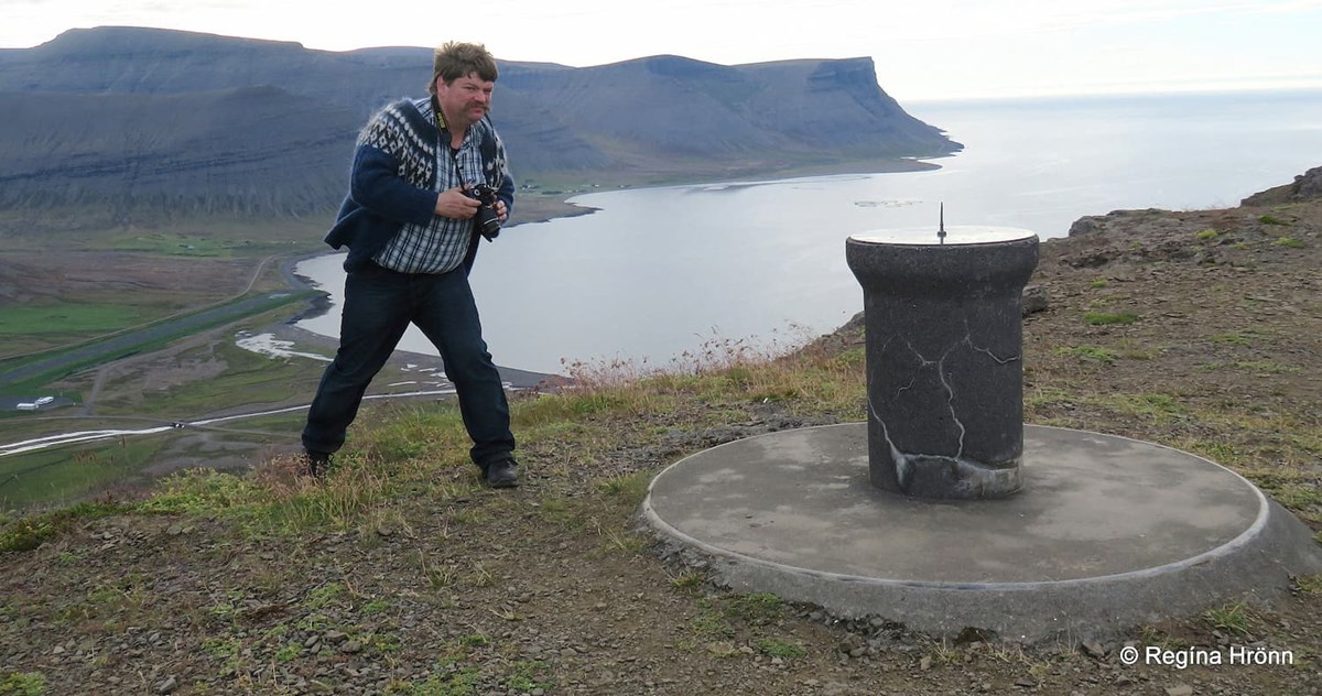
My husband was busy photographing the view-dial on top of Mt. Sandafell
As I told you earlier, then my husband always photographs me standing by the view-dial to show the height of the pillar. So I have photos of me by all the view-dials.
It was so windy on top of Mt. Sandafell, plus that it was getting dark that I was a bit reluctant to turn my back to the edge of the mountain.
So I took a photo of him instead and you can see in the photo how low the pillar is, compared to many other view-dial pillars.
The view of parts of Þingeyri village, Dýrafjörður fjord and Gemlufallsheiði heath
From the top, there is a beautiful view of the surrounding fjords and mountains.
The view is absolutely breathtaking in all directions.
It was getting dark, so my photos are dark, but I hope to be able to visit Mt. Sandafell again in sunny weather and take better photos.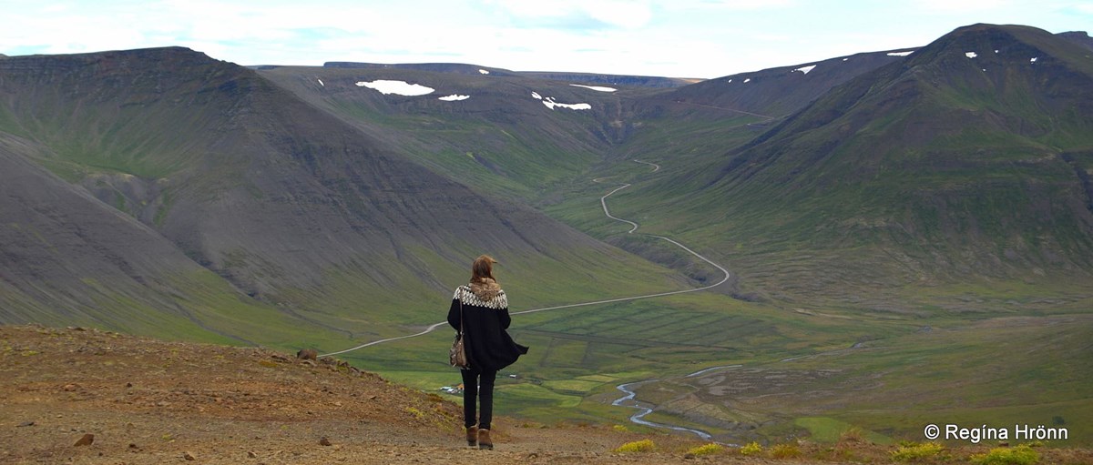
Looking in the direction of Hrafnseyrarheiði heath
My grandmother was born here between Dýrafjörður and Önundarfjörður fjords in Sæból at Ingjaldssandur in the Westfjords of Iceland - my Grandmother's Birthplace.
As I was walking down the mountain to the car following the gravel road, it all of a sudden felt like I was walking off the edge of the mountain - a trick of the eye, very scary.
An American friend of mine told me that the same thing happened to her, so bear this in mind if you will be visiting Mt. Sandafell.
It looks like the road falls off the edge of the mountain from this angle
This area is where Gísla Saga Súrssonar took place, but Gísli and his brother Þorkell lived at Sæból in Haukadalur in Dýrafjörður for some time.
When their sister, Þórdís, got married to Þorgrímur, she got Sæból farm and the brothers built the farm Hóll across the river from Sæból.
Þórdís and Þorgrímur were the parents of Snorri goði at Helgafell on the Snæfellsnes peninsula.
This is a very interesting Saga, which I recommend reading. 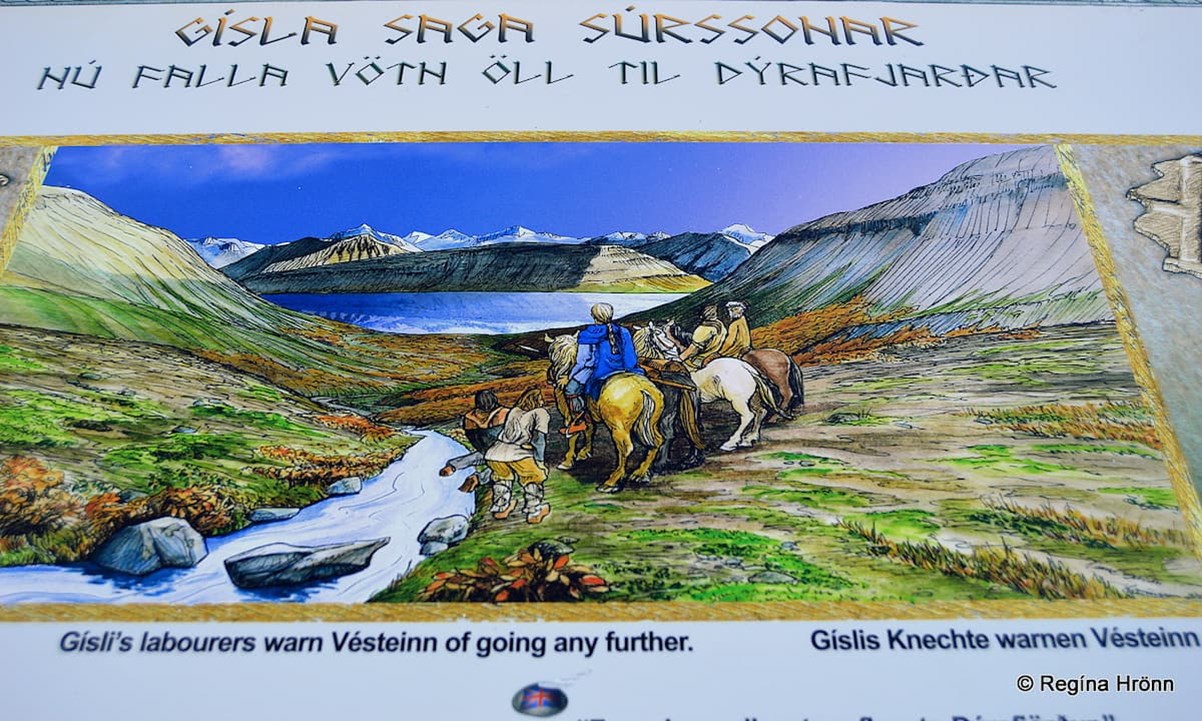
The Saga sign on Gemlufallsheiði heath - looking in the direction of Dýrafjörður fjord
You will see excellent information signs about Gísli in historic locations in the Westfjords, one of them is on Gemlufallsheiði heath.
That sign tells us about Vésteinn, the brother-in-law of Gísli, coming to visit him. Gísli had a hunch that Vésteinn was going to be killed at Gísli's home, so he sent his labourers to warn Vésteinn.
But they missed him as they didn't take the same route, and when they finally met up with Vésteinn he said the following: "...Nú falla öll vötn til Dýrafjarðar..." meaning: "...From here all waters flow to Dýrafjörður..." and that it was too late to return back to his home in Önundarfjörður.
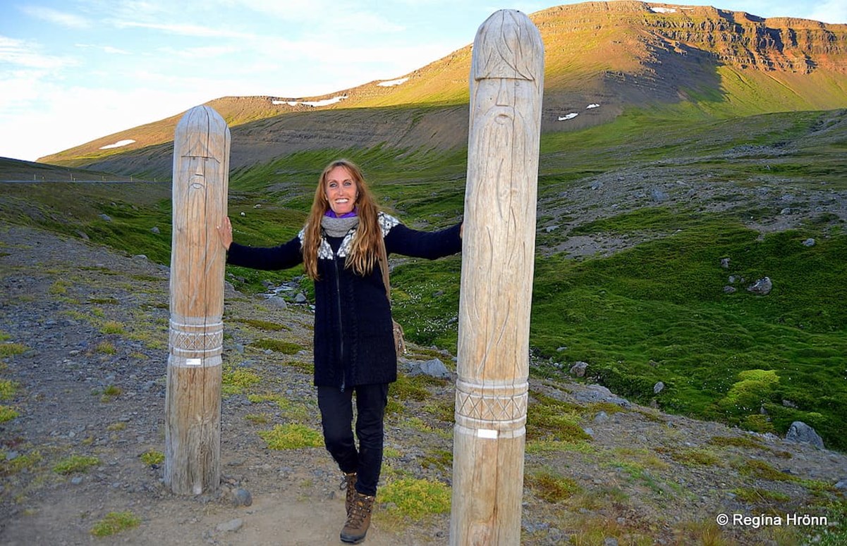
Wooden memorial poles for the Viking settlers by the information signs on Gemlufallsheiði heath
Vésteinn got killed and a chain of heartbreaking events took place where Gísli killed Þorgrímur, his sister's husband while she was in their bed-closet beside him (and pregnant at the time), and became an outlaw.
The next view-dial is located above Flateyri village in Önundarfjörður fjord, which is the next fjord north of Dýrafjörður fjord. Let's return back to road 60 and continue driving via Gemlufallsheiði heath and turn on road 64 leading to Flateyri village.
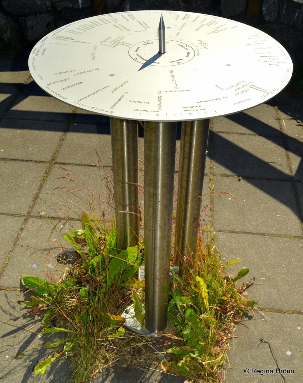
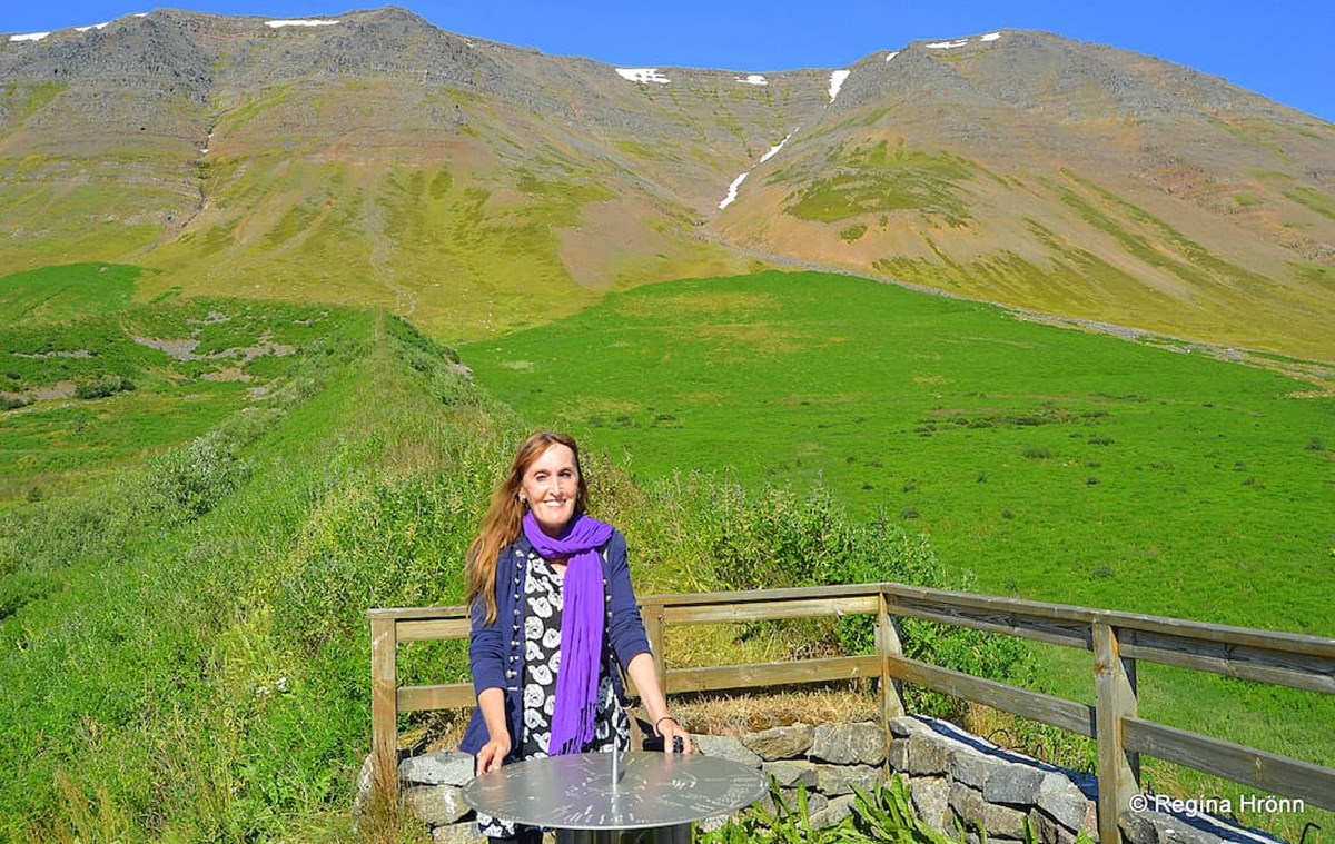
The View-Dial in Flateyri in Önundarfjörður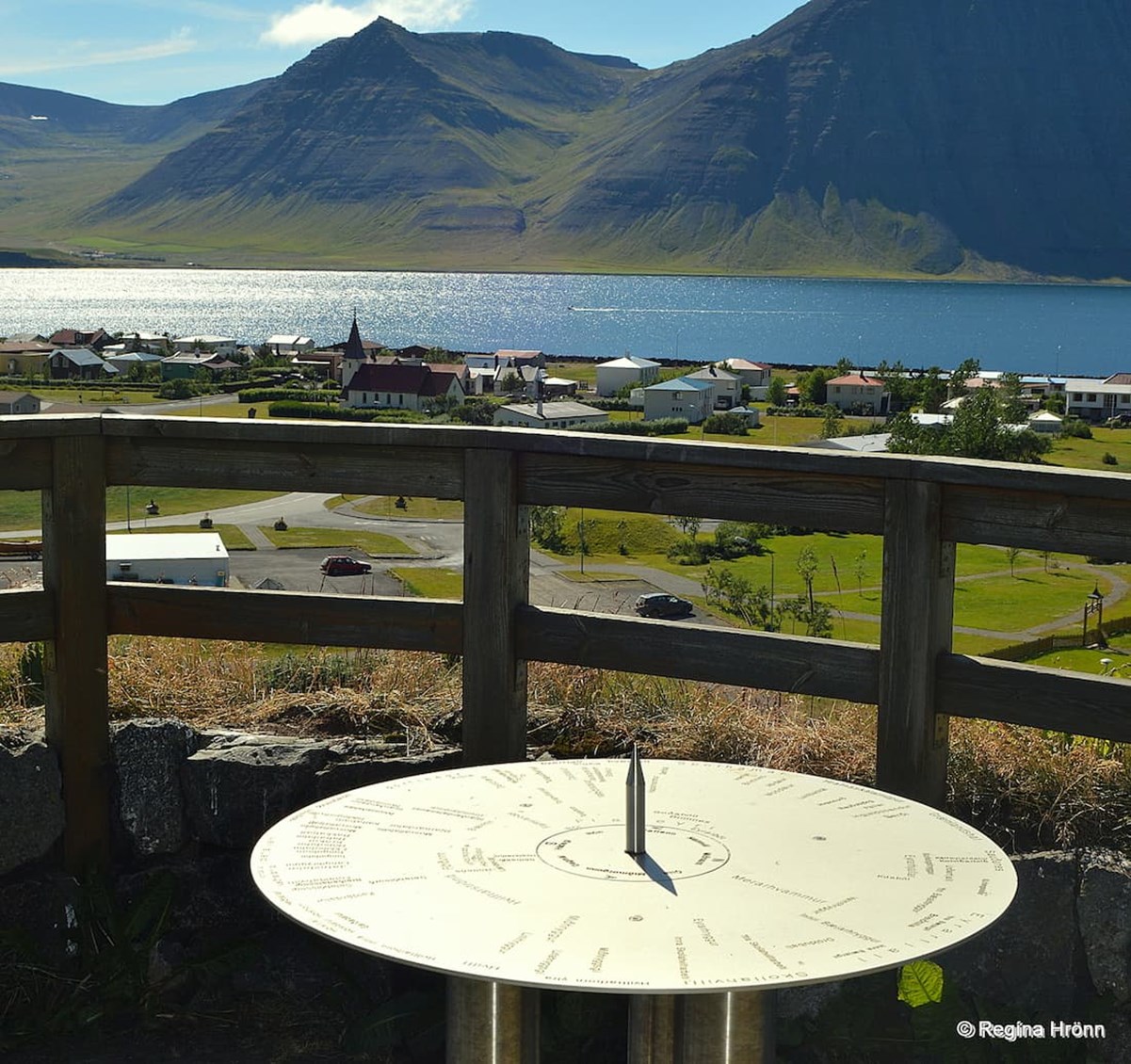
The view-dial in Flateyri - the view of Önundarfjörður fjord
In Flateyri in Önundarfjörður, you will find a view-dial on a platform by the avalanche barriers above the village.
The view-dial was erected in 2000 by the Kiwani's Club Þorfinnur and the designer is Guðmundur Björgvinsson.
The view-dial is an aluminum plate and shows a time of 3 hours.
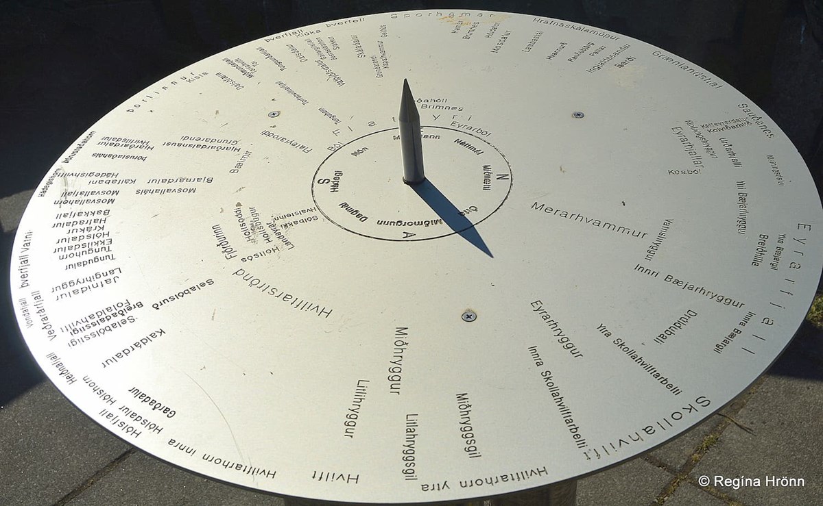
The aluminum view-dial at Flateyri
The pillar is 3 rust-free pipes on a flagged platform with a wooden railing. As the plate is made of aluminum it is not as shiny as some of the other view-dials, meaning that the surroundings don't reflect in it.
To reach the view-dial you walk towards the mountains above Flateyri village and go through a short tunnel on the avalanche barriers.

The barriers and tunnel leading to the view-dial in Flateyri
You will find several such avalanche barriers in the Westfjords as the mountains here are tall and avalanches are frequent, as I told you about in my travel-blogs about the village Súðavík where an avalanche fell on the village in January 1995.
I also told you about Hnífsdalur, where my great-grandfather got caught in a big avalanche back in 1910.
These beautiful mountains, which can be so pretty in the summertime, can be so unforgiving in the wintertime.
The avalanche barriers protect the inhabitants from avalanches in the wintertime. Two major avalanches fell on Flateyri back in 1995, but 1995 was a very tragic year for the inhabitants of the Westfjords.
The first avalanche fell on the 18th of January from Innra-Bæjargil and caused minor damage to 2 houses. The second avalanche fell on the 26th of October from Skollahvilft.
Twenty people got killed in that avalanche and 29 houses were damaged or destroyed :(
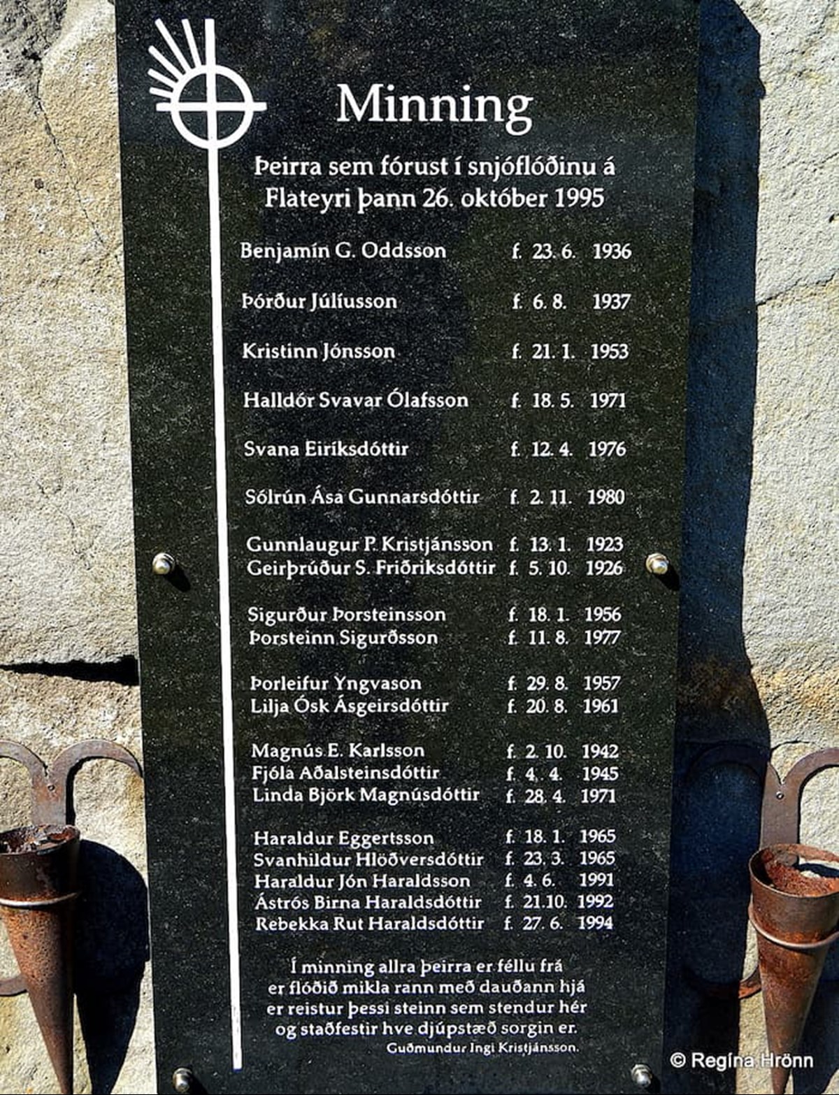
The memorial for the victims of the 1995 avalanche in Flateyri
I remember well how the whole nation was holding its breath while the rescue party was searching for survivors buried beneath the huge amount of snow, praying that they would be found alive.
You will find a memorial for the 20 victims of the avalanche by Flateyrarkirkja church.
Another avalanche bypassed the avalanche barriers and hit a house in January 2020. A girl was rescued from the house and fortunately, there were no fatalities.
Ósvör maritime museum in Bolungarvík
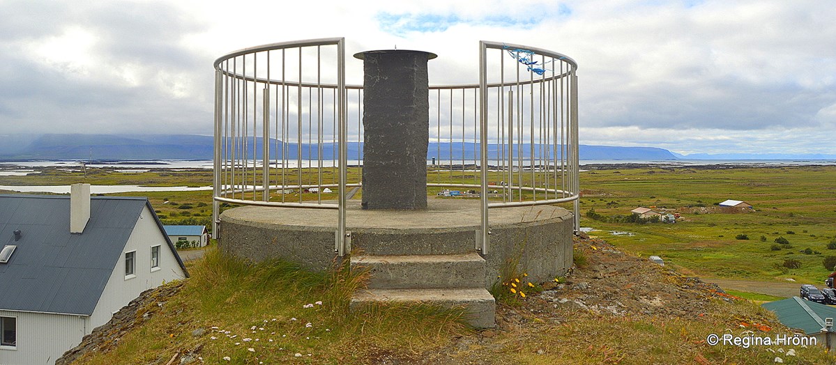
The next view-dial is at Óshólar in Bolungarvík.
Return to road 60 and continue driving until you reach the tunnel by Botnsheiði heath. When you come through the tunnel you will have reached Skutulsfjörður, by which Ísafjörður town, the capital city of the Westfjords, stands.
We have by now reached road 61, Djúpvegur road, on the northern part of the Westfjords and will be driving to the last village on road 61, Bolungarvík.
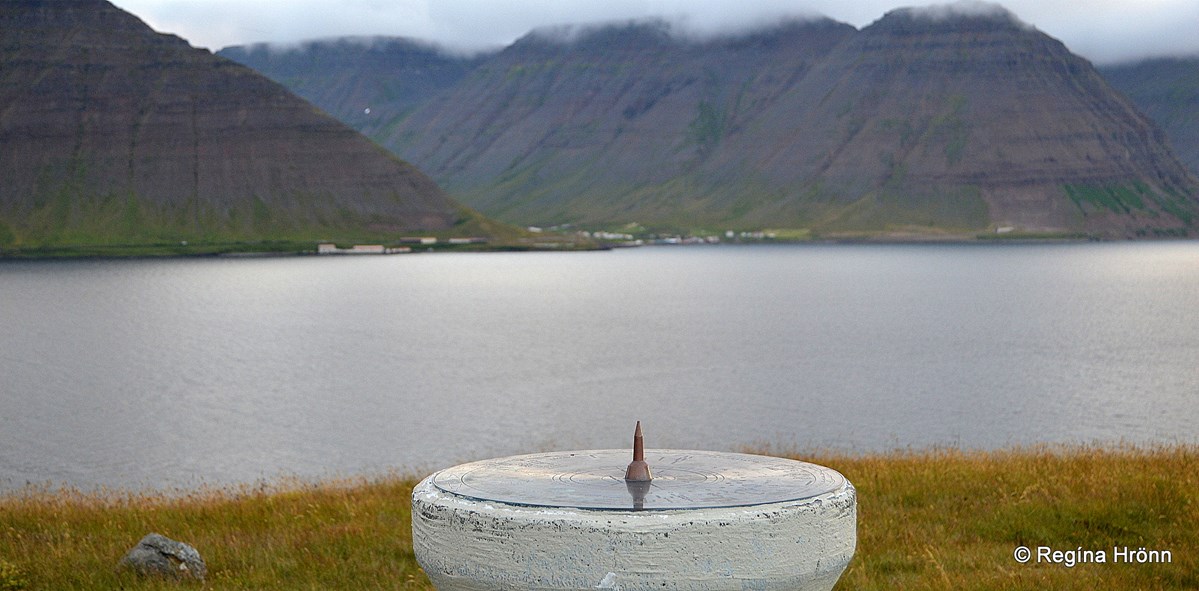
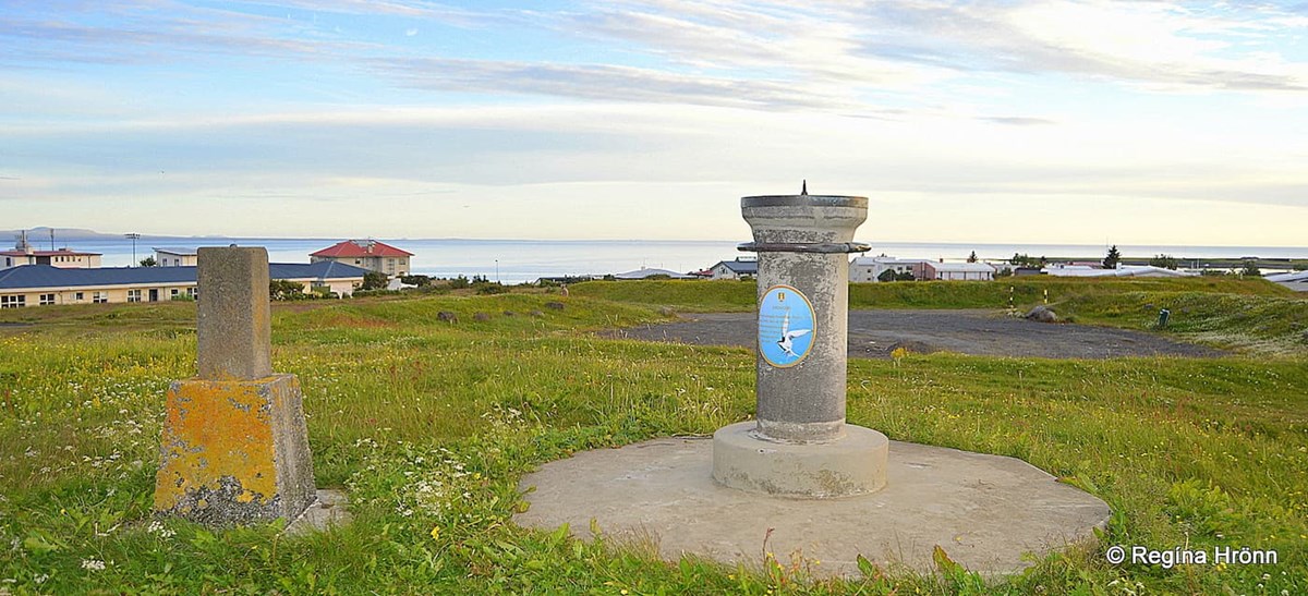
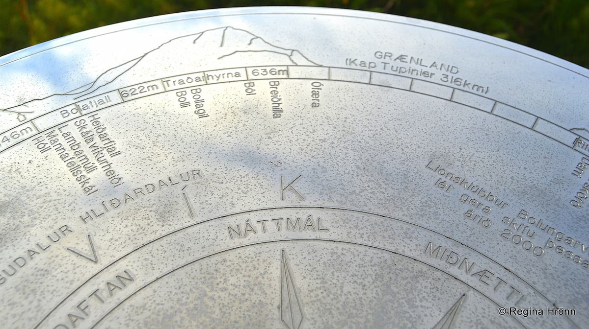
The View-dial at Óshólar in Bolungarvík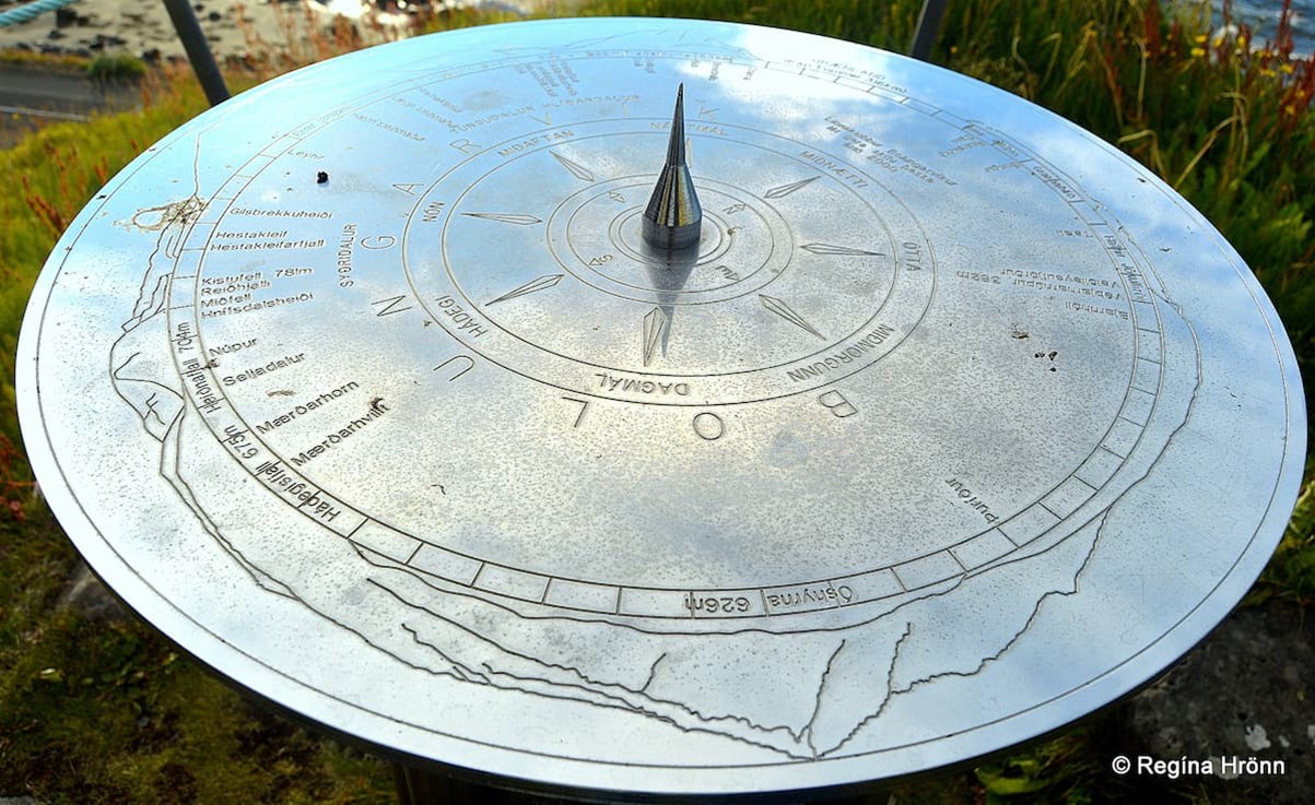
The view-dial at Óshólar hill - a chrome-plated copperplate - the blue sky reflects in the view-dial
To reach Bolungarvík you drive through a 5.6 km long tunnel from Hnífsdalur village on road 61. You turn right for the view-dial on road 6302, instead of driving to the village on road 61.
Before you reach Ósvör Maritime Museum you will see the view-dial at Óshólar hill.
Remember Ósvör maritime museum from my Bolungarvík travel-blog: Visiting Bolungarvík Village in the Westfjords of Iceland - the End of Road 61 Djúpvegur.
Ósvör Maritime Museum
It is a good idea to combine a visit to that museum with a visit to the view-dial.
We left our car at the parking by Ósvör and walked to the view-dial.
The designer of this view-dial is Pétur Guðmundsson artist and painter at Ísafjörður, and Jón Sigurpálsson, an artist in Ísafjörður, designed the beautiful pillar.
The view-dial at Óshólar
This view-dial was erected by the Lions Club of Bolungarvík in 2000.
It has a chrome-plated copperplate and shows the names of the surrounding mountains, the height of the mountains, and the time of 3 hours.
If you look closely at my photo above then you can see that Greenland is marked on the view-dial.
Greenland is 316 km away and cannot be seen from Óshólar, but it is a good gesture to add it to show us how close Greenland really is to Iceland.
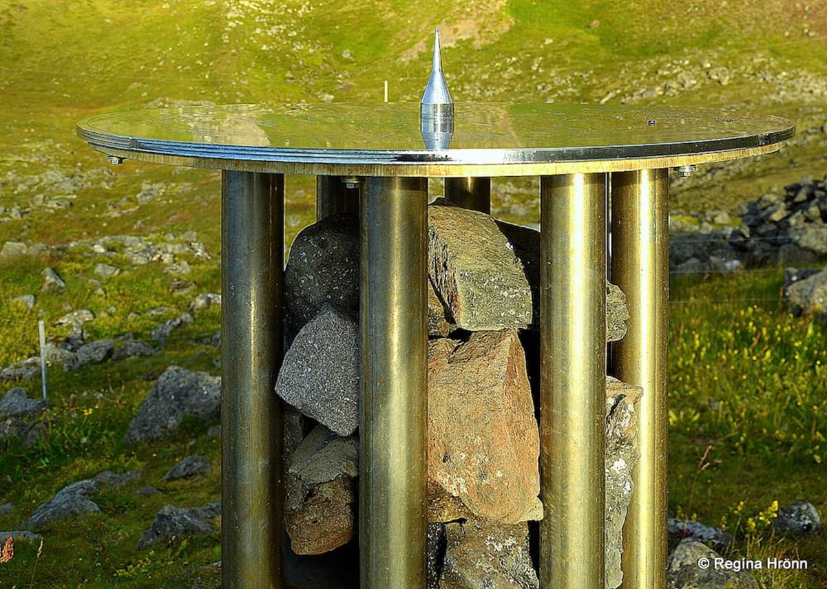
The view-dial at Óshólar- the rust-free pipes and the two types of rock on the shelves
I find the design of the pillar so pretty, especially when the sun shone on it and lit it up.
The pillar is made of several rust-free pipes with 2 shelves. On the upper shelf are rocks from the mountain and on the lower shelf are rocks from the seashore.
My 8th photo in this travel-blog is of the view-dial sign pointing towards the view-dial on the hill.
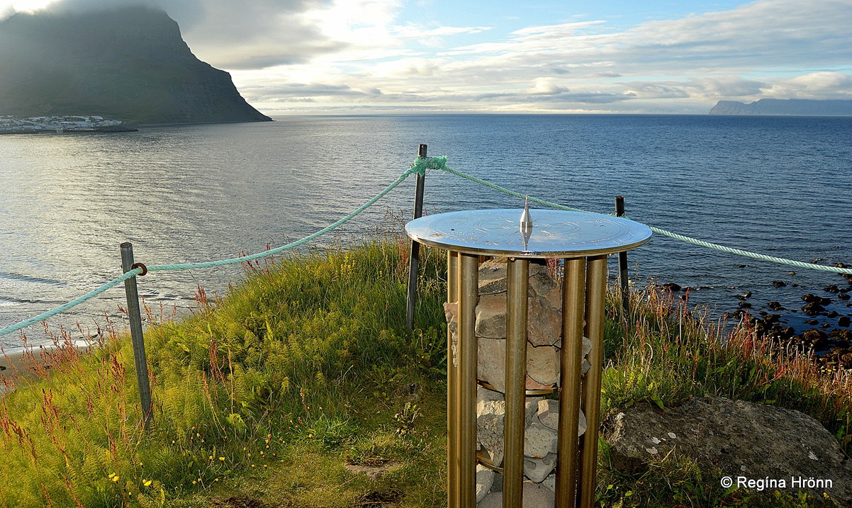
The view from the view-dial on Óshólar hill. You will see Bolungarvík village to the left
The next view-dial is relatively close by on Arnarneshamar in Skutulsfjörður.
So after visiting Bolungarvík village, we return back to Skutulsfjörður, visit Ísafjörður town, and continue driving on road 61 until we reach Arnarnes.
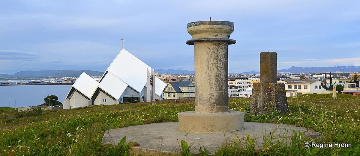
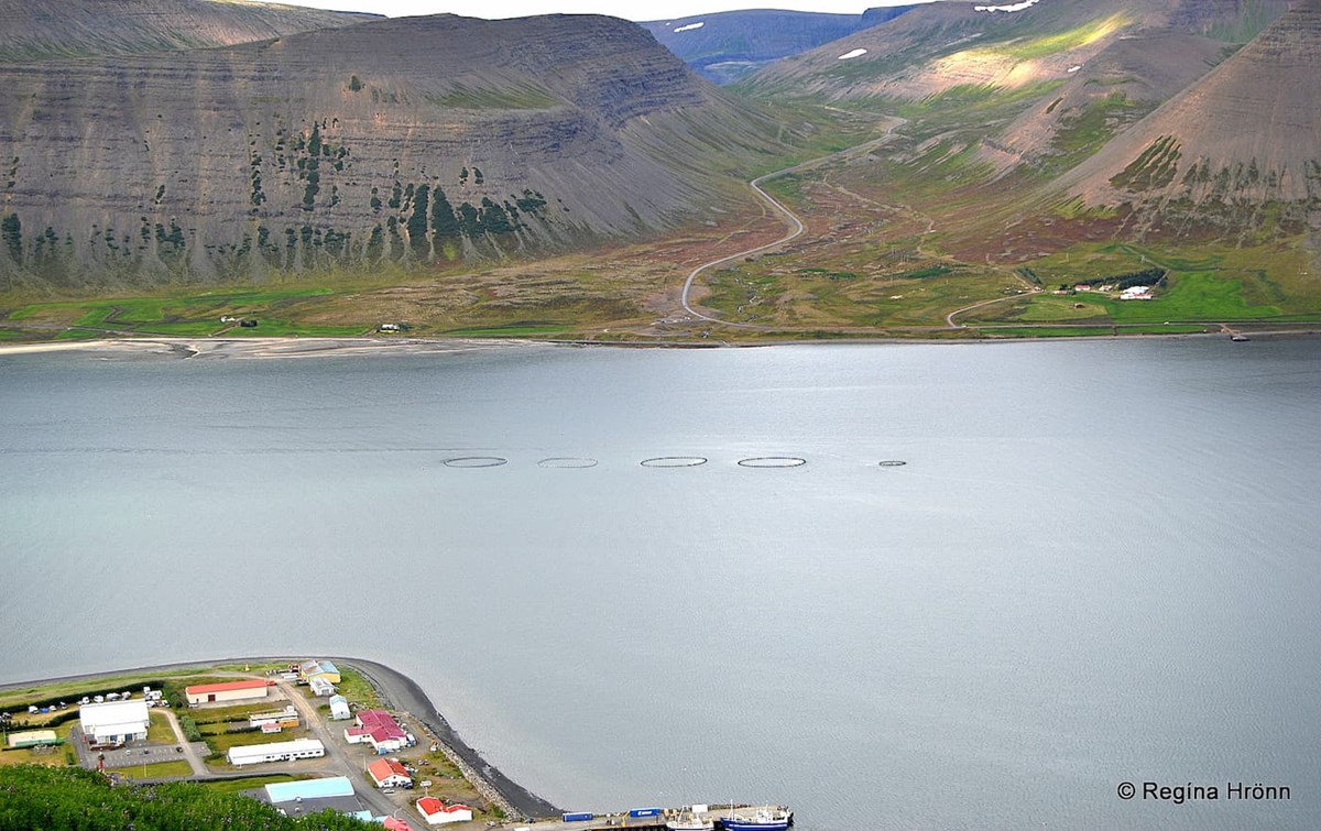
The View-dial on Arnarnes by Skutulsfjörður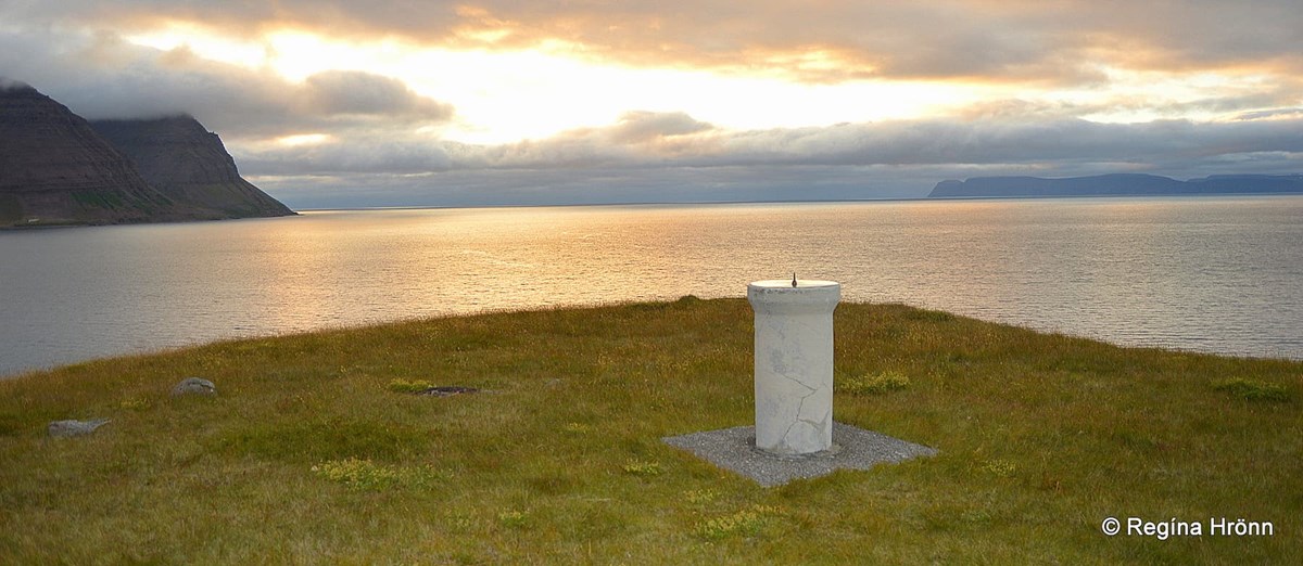
Isn't this pretty? The view from Arnarnes
There is a view-dial on Arnarnes by Skutulsfjörður. Remember the Arnarneshamar (Arnardalshamar) tunnel, the oldest tunnel in Iceland which I told you about in my Ísafjörður and Súðavík travel-blogs?
This view-dial was designed by Ágúst Böðvarsson and erected in 1983 by the Rotary Club of Ísafjörður. Kudos to the Rotary clubs for erecting all these lovely view-dials :) 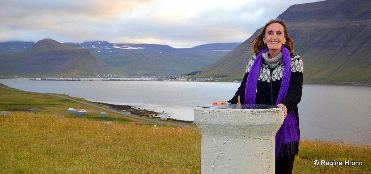
By the view-dial at Arnarnes
The view-dial is a copperplate and shows a time of 3 hours and the names and height of the surrounding mountains.
It stands on a molten pipe on a square molten platform.
The view-dial at Arnarnes was dirty with bird droppings and we always do our best to clean the view-dials before photographing them.
It was easier said than done with this view-dial. We were to find out why shortly...
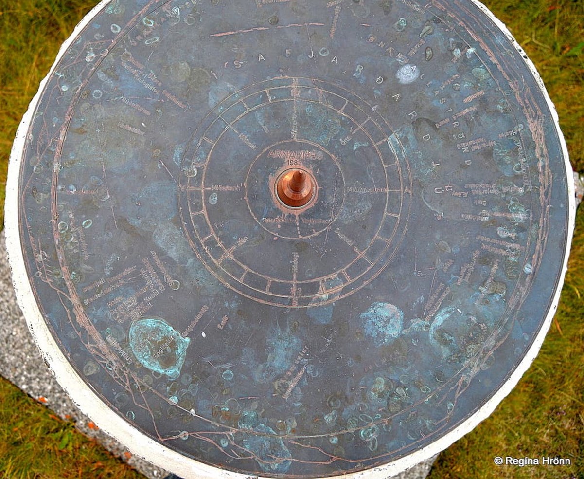
The view-dial at Arnarnes
This is the best I could do in cleaning the view-dial.
There is a lovely view from Arnarnes and I would recommend visiting it if only for the view.
But then it is a given that most of the view-dials are to be found on good observation spots.
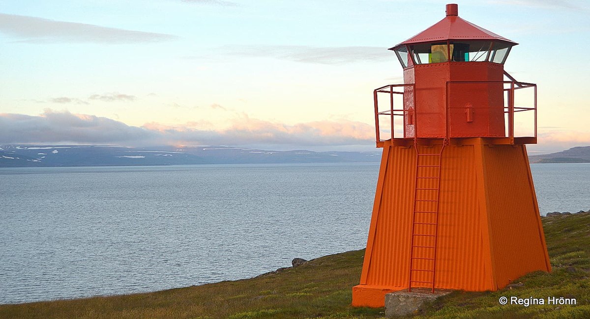
We enjoyed this wonderful view for a long while. You will also find a small lighthouse at Arnarnes, Arnarnesviti lighthouse, built in 1921. It is 5.4 meters tall.
Arnarnesviti lighthouse
When we went back to the car we noticed that it was surrounded by a flock of Arctic terns, which attacked us big time. And we now understood why the view-dial was so dirty.
The Arctic tern attacks when it thinks you are too close to its nesting grounds, but this bird has a tendency to sort me out and attack me even though I am far away from its nest or chicks.
It is best to hold a stick or an umbrella as protection from this bird.
We took a video from the car:
This is the last view-dial that we visited in the Westfjords.
Then we have a view-dial at Hornstrandir, which I don't think I am ever going to see. And a view-dial at Kambsnes which I missed by a month. And the one in Flatey island which was too dirty for a photo at the time of our visit. That sums up the view-dials in the Westfjords.
I have photographed the major part of view-dials in Iceland and have a huge view-dial photo album.
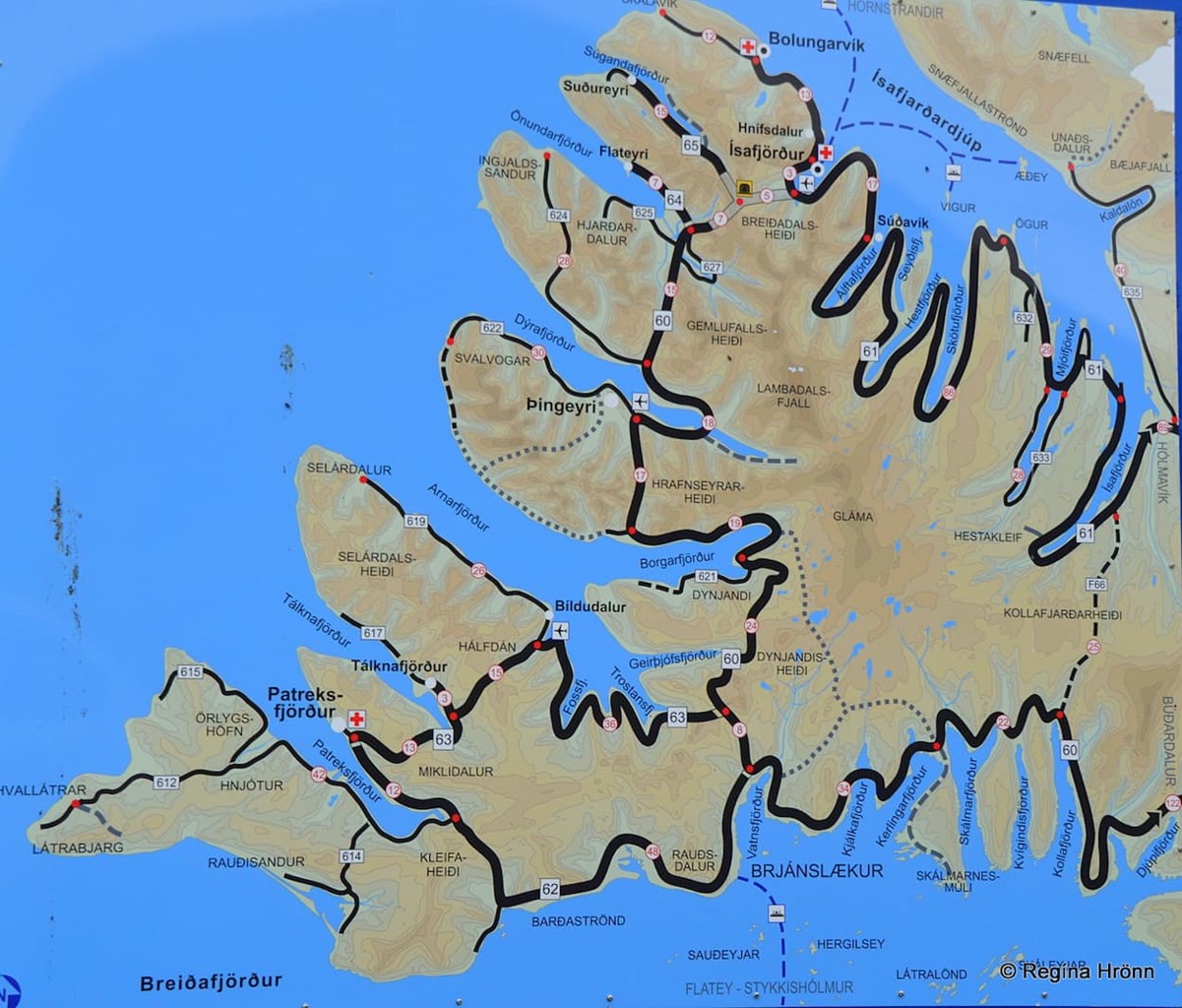
A map of the Westfjords
I hope you enjoyed the view-dials I show you here and maybe this will increase your interest in looking for them or at least check them out when you see them on your travels in Iceland.
The travel-blogs I have written in chronological order about the northern part of the Westfjords are:
A lovely Visit to Reykjanes in the Westfjords
Vatnsfjörður in the Westfjords - the Viking Estate and Grettisvarða Cairn
Litlibær Turf House on the Hvítanes Peninsula in the Westfjords - a Cute little Turf House Café
Watching the cute Seals at Hvítanes Peninsula in the Westfjords
Visiting Súðavík Village and Langeyri in Álftafjörður in the Westfjords
A Delightful Visit to Ísafjörður - the Capital City of the Westfjords
Hnífsdalur village in the Westfjords and the big Avalanche in 1910
Visiting Bolungarvík Village - the End of Road 61
Have a lovely time in the wonderful Westfjords of Iceland :)